Essigny-le-Grand geodata
Essigny-le-Grand (Hauts-de-France) is a populated place; located in France in Europe/Paris (GMT+2) time zone. With population of 1,216 people, there are 7451 cities with bigger population in this country. Compared to other cities in France, 92.1% of cities are located further ↓South; 61.7% of cities are located further ←West and 58.3% of cities have higher elevation than Essigny-le-Grand. Note1
Administrative division(s):
- Level 1: Hauts-de-France
- Level 2: Département de l'Aisne
- Level 3: Arrondissement de Saint-Quentin
- Level 4: Essigny-le-Grand


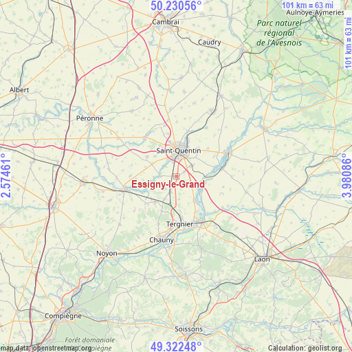
Essigny-le-Grand GPS coordinates[2]
49° 46' 43.14" North, 3° 16' 39.864" East
| Map corner | latitude | longitude |
|---|---|---|
| Upper-left | 50.23056°, | 2.57461° |
| Center: | 49.77865°, | 3.27774° |
| Lower-right: | 49.32248°, | 3.98086° |
| Map W x H: | 101×101 km | = 62.8×62.8mi |
| max Lat: | 51.07786° ⇑7.9% North |
| Essigny-le-Grand: | 49.77865° |
| min Lat: | ⇓92.1% South 41.3874° |
| min Long | Essigny-le-Gran | max Long |
| -5.08615° | 3.27774° | 9.52242° |
| W 61.7%⇐ | ⇒38.3% E |
Elevation
Elevation of Essigny-le-Grand is 107 m = 351 ft, and this is 86.7 m = 284 ft below average elevation for this country.
| Max E: |
2333 m = 7654 ft | 58.3% |
| Avg. | 193.7 m = 635 ft | |
| Essigny-le-Grand | 107 m = 351 ft | |
Min E: |
-1 m = -3 ft | 41.7% |
See also: France elevation on elevation.city.
Geographical zone
Essigny-le-Grand is located in North temperate zone (between Tropic of Cancer and the Arctic Circle). Distance of this North polar circle is 1866.3 km =1159.7 mi to North.| Distance of | km | miles | from Essigny-le-Grand |
|---|---|---|---|
| North Pole | 4472.2 | 2778.9 | to North |
| Arctic Circle | 1866.3 | 1159.7 | to North |
| Tropic Cancer | 2928.9 | 1819.9 | to South |
| Equator | 5534.9 | 3439.2 | to South |


Nearby cities:
15 places around Essigny-le-Grand: (largest is in red/bold)
• Clastres
4.8 km =3 mi,  221°
221°
• Gauchy
5.5 km =3.4 mi,  356°
356°
• Grugies
3.8 km =2.4 mi,  349°
349°
• Harly
7 km =4.3 mi,  19°
19°
• Itancourt
5.7 km =3.5 mi,  56°
56°
• Jussy
7.3 km =4.5 mi,  206°
206°
• Montescourt-Lizerolles
4.7 km =2.9 mi,  198°
198°
• Mézières-sur-Oise
9 km =5.6 mi,  86°
86°
• Neuville-Saint-Amand
6.6 km =4.1 mi,  37°
37°
• Saint-Quentin
7.8 km =4.8 mi,  5°
5°
• Saint-Simon
8.1 km =5 mi,  243°
243°
• Savy
8.3 km =5.2 mi,  314°
314°
• Seraucourt-le-Grand
4.4 km =2.7 mi,  276°
276°
• Urvillers
2.6 km =1.6 mi, 61°
• Vendeuil
8.8 km =5.5 mi,  142°
142°
Sources, notices
• [Note1] Compared only with cities in France existing in our database
• [Src1] Map data: © OpenStreetMap contributors (CC-BY-SA)
• [Src2] Other city data from geonames.org with taken over terms of usage.
• [Src3] Geographical zone / Annual Mean Temperature by Robert A. Rohde @ Wikipedia
