Urvillers geodata
Urvillers (Hauts-de-France) is a populated place; located in France in Europe/Paris (GMT+2) time zone. With population of 603 people, there are 13268 cities with bigger population in this country. Compared to other cities in France, 92.2% of cities are located further ↓South; 62.1% of cities are located further ←West and 55.2% of cities have higher elevation than Urvillers. Note1
Administrative division(s):
- Level 1: Hauts-de-France
- Level 2: Département de l'Aisne
- Level 3: Arrondissement de Saint-Quentin
- Level 4: Urvillers


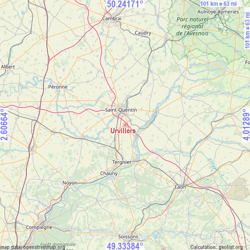
Urvillers GPS coordinates[2]
49° 47' 23.64" North, 3° 18' 35.136" East
| Map corner | latitude | longitude |
|---|---|---|
| Upper-left | 50.24171°, | 2.60664° |
| Center: | 49.7899°, | 3.30976° |
| Lower-right: | 49.33384°, | 4.01289° |
| Map W x H: | 100.9×100.9 km | = 62.7×62.7mi |
| max Lat: | 51.07786° ⇑7.8% North |
| Urvillers: | 49.7899° |
| min Lat: | ⇓92.2% South 41.3874° |
| min Long | Urvillers | max Long |
| -5.08615° | 3.30976° | 9.52242° |
| W 62.1%⇐ | ⇒37.9% E |
Elevation
Elevation of Urvillers is 116 m = 381 ft, and this is 77.7 m = 255 ft below average elevation for this country.
| Max E: |
2333 m = 7654 ft | 55.2% |
| Avg. | 193.7 m = 635 ft | |
| Urvillers | 116 m = 381 ft | |
Min E: |
-1 m = -3 ft | 44.8% |
See also: France elevation on elevation.city.
Geographical zone
Urvillers is located in North temperate zone (between Tropic of Cancer and the Arctic Circle). Distance of this North polar circle is 1865.1 km =1158.9 mi to North.| Distance of | km | miles | from Urvillers |
|---|---|---|---|
| North Pole | 4470.9 | 2778.1 | to North |
| Arctic Circle | 1865.1 | 1158.9 | to North |
| Tropic Cancer | 2930.2 | 1820.7 | to South |
| Equator | 5536.1 | 3440 | to South |


Nearby cities:
15 places around Urvillers: (largest is in red/bold)
• Clastres
7.4 km =4.6 mi,  228°
228°
• Essigny-le-Grand
2.6 km =1.6 mi,  241°
241°
• Gauchy
4.9 km =3 mi,  328°
328°
• Grugies
3.9 km =2.4 mi,  309°
309°
• Harly
5.3 km =3.3 mi,  0°
0°
• Homblières
7.8 km =4.8 mi,  30°
30°
• Itancourt
3.1 km =1.9 mi,  53°
53°
• Montescourt-Lizerolles
6.9 km =4.3 mi,  213°
213°
• Mézières-sur-Oise
6.7 km =4.2 mi,  96°
96°
• Neuville-Saint-Amand
4.4 km =2.7 mi,  23°
23°
• Saint-Quentin
6.7 km =4.2 mi,  346°
346°
• Seraucourt-le-Grand
6.7 km =4.2 mi,  263°
263°
• Sissy
8.5 km =5.3 mi,  81°
81°
• Séry-lès-Mézières
8.2 km =5.1 mi, 102°
• Vendeuil
8.8 km =5.5 mi,  159°
159°
Sources, notices
• [Note1] Compared only with cities in France existing in our database
• [Src1] Map data: © OpenStreetMap contributors (CC-BY-SA)
• [Src2] Other city data from geonames.org with taken over terms of usage.
• [Src3] Geographical zone / Annual Mean Temperature by Robert A. Rohde @ Wikipedia
