Ingersheim geodata
Ingersheim (Grand Est) is a populated place; located in France in Europe/Paris (GMT+2) time zone. With population of 4,368 people, there are 2255 cities with bigger population in this country. Compared to other cities in France, 61.1% of cities are located further ↓South; 96.6% of cities are located further ←West and 69.6% of cities have lower elevation than Ingersheim. Note1
Administrative division(s):
- Level 1: Grand Est
- Level 2: Haut-Rhin
- Level 3: Arrondissement de Colmar-Ribeauvillé
- Level 4: Ingersheim


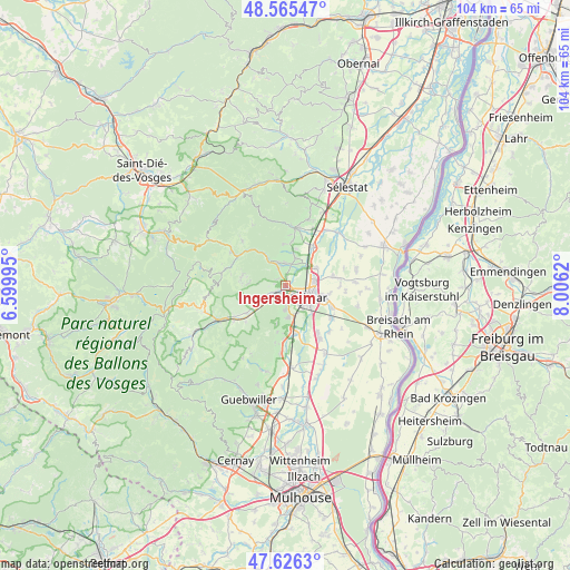
Ingersheim GPS coordinates[2]
48° 5' 52.908" North, 7° 18' 11.088" East
| Map corner | latitude | longitude |
|---|---|---|
| Upper-left | 48.56547°, | 6.59995° |
| Center: | 48.09803°, | 7.30308° |
| Lower-right: | 47.6263°, | 8.0062° |
| Map W x H: | 104.4×104.4 km | = 64.9×64.9mi |
| max Lat: | 51.07786° ⇑38.9% North |
| Ingersheim: | 48.09803° |
| min Lat: | ⇓61.1% South 41.3874° |
| min Long | Ingersheim | max Long |
| -5.08615° | 7.30308° | 9.52242° |
| W 96.6%⇐ | ⇒3.4% E |
Elevation
Elevation of Ingersheim is 217 m = 712 ft, and this is 23.3 m = 76 ft above average elevation for this country.
| Max E: |
2333 m = 7654 ft | 30.4% |
| Ingersheim | 217 m 712 ft | |
| Avg. | 193.7 m = 635 ft | |
Min E: |
-1 m = -3 ft | 69.6% |
See also: France elevation on elevation.city.
Geographical zone
Ingersheim is located in North temperate zone (between Tropic of Cancer and the Arctic Circle). Distance of this North polar circle is 2053.2 km =1275.8 mi to North.| Distance of | km | miles | from Ingersheim |
|---|---|---|---|
| North Pole | 4659.1 | 2895 | to North |
| Arctic Circle | 2053.2 | 1275.8 | to North |
| Tropic Cancer | 2742.1 | 1703.9 | to South |
| Equator | 5348 | 3323.1 | to South |


Nearby cities:
15 places around Ingersheim: (largest is in red/bold)
• Ammerschwihr
3.4 km =2.1 mi,  333°
333°
• Bennwihr
5.4 km =3.4 mi,  17°
17°
• Colmar
4.4 km =2.7 mi,  116°
116°
• Eguisheim
6.1 km =3.8 mi,  177°
177°
• Houssen
6.3 km =3.9 mi,  60°
60°
• Katzenthal
1.9 km =1.2 mi,  305°
305°
• Kaysersberg
5.3 km =3.3 mi, 326°
• Kientzheim
4.4 km =2.7 mi,  343°
343°
• Mittelwihr
6 km =3.7 mi,  11°
11°
• Niedermorschwihr
2.2 km =1.4 mi,  275°
275°
• Sigolsheim
4.1 km =2.5 mi,  356°
356°
• Turckheim
2.3 km =1.4 mi,  238°
238°
• Wettolsheim
4.5 km =2.8 mi, 184°
• Wintzenheim
3 km =1.9 mi,  198°
198°
• Zimmerbach
5.7 km =3.5 mi, 241°
Sources, notices
• [Note1] Compared only with cities in France existing in our database
• [Src1] Map data: © OpenStreetMap contributors (CC-BY-SA)
• [Src2] Other city data from geonames.org with taken over terms of usage.
• [Src3] Geographical zone / Annual Mean Temperature by Robert A. Rohde @ Wikipedia
