Zimmerbach geodata
Zimmerbach (Grand Est) is a populated place; located in France in Europe/Paris (GMT+2) time zone. With population of 904 people, there are 9617 cities with bigger population in this country. Compared to other cities in France, 60.7% of cities are located further ↓South; 96% of cities are located further ←West and 81.2% of cities have lower elevation than Zimmerbach. Note1
Administrative division(s):
- Level 1: Grand Est
- Level 2: Haut-Rhin
- Level 3: Arrondissement de Colmar-Ribeauvillé
- Level 4: Zimmerbach


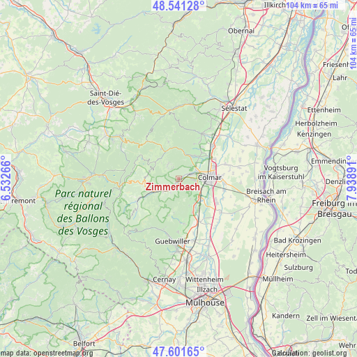
Zimmerbach GPS coordinates[2]
48° 4' 24.996" North, 7° 14' 8.808" East
| Map corner | latitude | longitude |
|---|---|---|
| Upper-left | 48.54128°, | 6.53266° |
| Center: | 48.07361°, | 7.23578° |
| Lower-right: | 47.60165°, | 7.93891° |
| Map W x H: | 104.5×104.5 km | = 64.9×64.9mi |
| max Lat: | 51.07786° ⇑39.3% North |
| Zimmerbach: | 48.07361° |
| min Lat: | ⇓60.7% South 41.3874° |
| min Long | Zimmerbach | max Long |
| -5.08615° | 7.23578° | 9.52242° |
| W 96%⇐ | ⇒4% E |
Elevation
Elevation of Zimmerbach is 302 m = 991 ft, and this is 108.3 m = 355 ft above average elevation for this country.
| Max E: |
2333 m = 7654 ft | 18.8% |
| Zimmerbach | 302 m 991 ft | |
| Avg. | 193.7 m = 635 ft | |
Min E: |
-1 m = -3 ft | 81.2% |
See also: France elevation on elevation.city.
Geographical zone
Zimmerbach is located in North temperate zone (between Tropic of Cancer and the Arctic Circle). Distance of this North polar circle is 2055.9 km =1277.5 mi to North.| Distance of | km | miles | from Zimmerbach |
|---|---|---|---|
| North Pole | 4661.8 | 2896.7 | to North |
| Arctic Circle | 2055.9 | 1277.5 | to North |
| Tropic Cancer | 2739.4 | 1702.2 | to South |
| Equator | 5345.3 | 3321.4 | to South |


Nearby cities:
15 places around Zimmerbach: (largest is in red/bold)
• Ammerschwihr
6.7 km =4.2 mi,  31°
31°
• Eguisheim
6.3 km =3.9 mi,  123°
123°
• Griesbach-au-Val
6.3 km =3.9 mi,  228°
228°
• Gunsbach
5.3 km =3.3 mi,  237°
237°
• Ingersheim
5.7 km =3.5 mi,  61°
61°
• Katzenthal
5.1 km =3.2 mi,  41°
41°
• Labaroche
5.2 km =3.2 mi,  322°
322°
• Niedermorschwihr
4 km =2.5 mi, 43°
• Soultzbach-les-Bains
4.6 km =2.9 mi,  210°
210°
• Turckheim
3.4 km =2.1 mi, 63°
• Vœgtlinshoffen
6.8 km =4.2 mi,  149°
149°
• Walbach
1.5 km =0.9 mi,  218°
218°
• Wettolsheim
5 km =3.1 mi,  110°
110°
• Wihr-au-Val
3.3 km =2.1 mi, 223°
• Wintzenheim
4.1 km =2.5 mi,  91°
91°
Sources, notices
• [Note1] Compared only with cities in France existing in our database
• [Src1] Map data: © OpenStreetMap contributors (CC-BY-SA)
• [Src2] Other city data from geonames.org with taken over terms of usage.
• [Src3] Geographical zone / Annual Mean Temperature by Robert A. Rohde @ Wikipedia
