Illhaeusern geodata
Illhaeusern (Grand Est) is a populated place; located in France in Europe/Paris (GMT+2) time zone. With population of 676 people, there are 12127 cities with bigger population in this country. Compared to other cities in France, 62.6% of cities are located further ↓South; 97.5% of cities are located further ←West and 61% of cities have lower elevation than Illhaeusern. Note1
Administrative division(s):
- Level 1: Grand Est
- Level 2: Haut-Rhin
- Level 3: Arrondissement de Colmar-Ribeauvillé
- Level 4: Illhaeusern


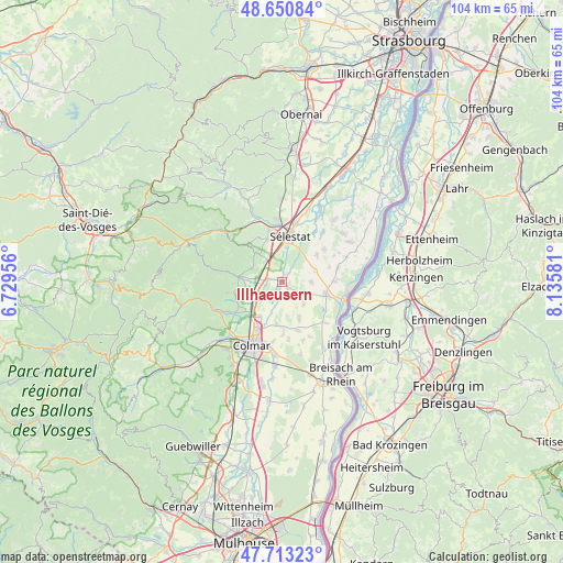
Illhaeusern GPS coordinates[2]
48° 11' 3.048" North, 7° 25' 57.648" East
| Map corner | latitude | longitude |
|---|---|---|
| Upper-left | 48.65084°, | 6.72956° |
| Center: | 48.18418°, | 7.43268° |
| Lower-right: | 47.71323°, | 8.13581° |
| Map W x H: | 104.3×104.2 km | = 64.8×64.7mi |
| max Lat: | 51.07786° ⇑37.4% North |
| Illhaeusern: | 48.18418° |
| min Lat: | ⇓62.6% South 41.3874° |
| min Long | Illhaeusern | max Long |
| -5.08615° | 7.43268° | 9.52242° |
| W 97.5%⇐ | ⇒2.5% E |
Elevation
Elevation of Illhaeusern is 175 m = 574 ft, and this is 18.7 m = 61 ft below average elevation for this country.
| Max E: |
2333 m = 7654 ft | 39% |
| Avg. | 193.7 m = 635 ft | |
| Illhaeusern | 175 m = 574 ft | |
Min E: |
-1 m = -3 ft | 61% |
See also: France elevation on elevation.city.
Geographical zone
Illhaeusern is located in North temperate zone (between Tropic of Cancer and the Arctic Circle). Distance of this North polar circle is 2043.6 km =1269.8 mi to North.| Distance of | km | miles | from Illhaeusern |
|---|---|---|---|
| North Pole | 4649.5 | 2889.1 | to North |
| Arctic Circle | 2043.6 | 1269.8 | to North |
| Tropic Cancer | 2751.7 | 1709.8 | to South |
| Equator | 5357.6 | 3329.1 | to South |


Nearby cities:
15 places around Illhaeusern: (largest is in red/bold)
• Beblenheim
8.4 km =5.2 mi,  249°
249°
• Bergheim
5.7 km =3.5 mi,  294°
294°
• Elsenheim
5.5 km =3.4 mi,  117°
117°
• Grussenheim
5.9 km =3.7 mi,  136°
136°
• Guémar
2.7 km =1.7 mi,  280°
280°
• Holtzwihr
8 km =5 mi,  186°
186°
• Houssen
7.7 km =4.8 mi,  212°
212°
• Jebsheim
7.4 km =4.6 mi,  154°
154°
• Kintzheim
8.3 km =5.2 mi,  340°
340°
• Marckolsheim
8.5 km =5.3 mi,  104°
104°
• Mussig
8.2 km =5.1 mi,  51°
51°
• Ohnenheim
5.5 km =3.4 mi,  90°
90°
• Orschwiller
7.3 km =4.5 mi,  330°
330°
• Ostheim
5.4 km =3.4 mi,  239°
239°
• Saint-Hippolyte
7 km =4.3 mi,  319°
319°
Sources, notices
• [Note1] Compared only with cities in France existing in our database
• [Src1] Map data: © OpenStreetMap contributors (CC-BY-SA)
• [Src2] Other city data from geonames.org with taken over terms of usage.
• [Src3] Geographical zone / Annual Mean Temperature by Robert A. Rohde @ Wikipedia
