Guémar geodata
Guémar (Grand Est) is a populated place; located in France in Europe/Paris (GMT+2) time zone. With population of 1,370 people, there are 6727 cities with bigger population in this country. Compared to other cities in France, 62.6% of cities are located further ↓South; 97.2% of cities are located further ←West and 61.6% of cities have lower elevation than Guémar. Note1
Administrative division(s):
- Level 1: Grand Est
- Level 2: Haut-Rhin
- Level 3: Arrondissement de Colmar-Ribeauvillé
- Level 4: Guémar


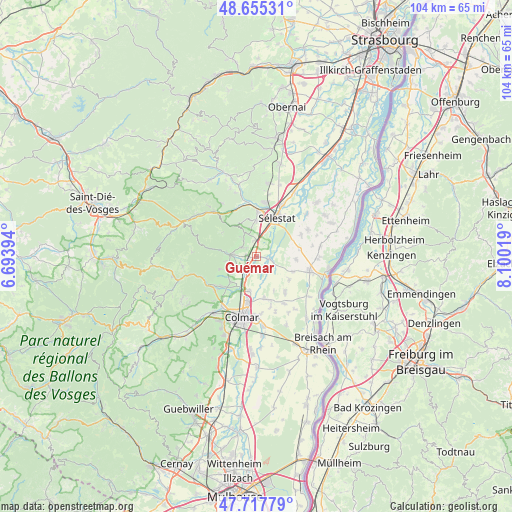
Guémar GPS coordinates[2]
48° 11' 19.284" North, 7° 23' 49.416" East
| Map corner | latitude | longitude |
|---|---|---|
| Upper-left | 48.65531°, | 6.69394° |
| Center: | 48.18869°, | 7.39706° |
| Lower-right: | 47.71779°, | 8.10019° |
| Map W x H: | 104.2×104.2 km | = 64.7×64.7mi |
| max Lat: | 51.07786° ⇑37.4% North |
| Guémar: | 48.18869° |
| min Lat: | ⇓62.6% South 41.3874° |
| min Long | Guémar | max Long |
| -5.08615° | 7.39706° | 9.52242° |
| W 97.2%⇐ | ⇒2.8% E |
Elevation
Elevation of Guémar is 178 m = 584 ft, and this is 15.7 m = 52 ft below average elevation for this country.
| Max E: |
2333 m = 7654 ft | 38.4% |
| Avg. | 193.7 m = 635 ft | |
| Guémar | 178 m = 584 ft | |
Min E: |
-1 m = -3 ft | 61.6% |
See also: France elevation on elevation.city.
Geographical zone
Guémar is located in North temperate zone (between Tropic of Cancer and the Arctic Circle). Distance of this North polar circle is 2043.1 km =1269.5 mi to North.| Distance of | km | miles | from Guémar |
|---|---|---|---|
| North Pole | 4649 | 2888.8 | to North |
| Arctic Circle | 2043.1 | 1269.5 | to North |
| Tropic Cancer | 2752.2 | 1710.1 | to South |
| Equator | 5358.1 | 3329.4 | to South |


Nearby cities:
15 places around Guémar: (largest is in red/bold)
• Beblenheim
6.3 km =3.9 mi,  235°
235°
• Bennwihr
7.3 km =4.5 mi,  227°
227°
• Bergheim
3.1 km =1.9 mi,  306°
306°
• Elsenheim
8.1 km =5 mi,  111°
111°
• Houssen
7.1 km =4.4 mi,  191°
191°
• Hunawihr
6.4 km =4 mi,  261°
261°
• Illhaeusern
2.7 km =1.7 mi,  100°
100°
• Kintzheim
7.4 km =4.6 mi,  358°
358°
• Mittelwihr
7.1 km =4.4 mi, 234°
• Ohnenheim
8.2 km =5.1 mi,  94°
94°
• Orschwiller
6 km =3.7 mi,  351°
351°
• Ostheim
3.8 km =2.4 mi,  212°
212°
• Ribeauvillé
5.8 km =3.6 mi,  277°
277°
• Riquewihr
7.8 km =4.8 mi,  251°
251°
• Saint-Hippolyte
5.1 km =3.2 mi,  338°
338°
Sources, notices
• [Note1] Compared only with cities in France existing in our database
• [Src1] Map data: © OpenStreetMap contributors (CC-BY-SA)
• [Src2] Other city data from geonames.org with taken over terms of usage.
• [Src3] Geographical zone / Annual Mean Temperature by Robert A. Rohde @ Wikipedia
