Saint-Hippolyte geodata
Saint-Hippolyte (Grand Est) is a populated place; located in France in Europe/Paris (GMT+2) time zone. With population of 1,107 people, there are 8081 cities with bigger population in this country. Compared to other cities in France, 63.3% of cities are located further ↓South; 97.1% of cities are located further ←West and 69.6% of cities have lower elevation than Saint-Hippolyte. Note1
Administrative division(s):
- Level 1: Grand Est
- Level 2: Haut-Rhin
- Level 3: Arrondissement de Colmar-Ribeauvillé
- Level 4: Saint-Hippolyte


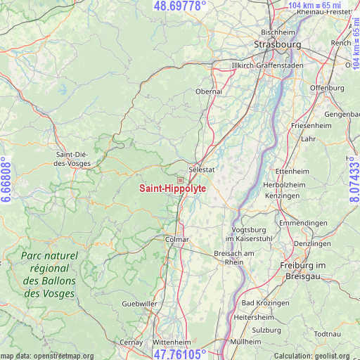
Saint-Hippolyte GPS coordinates[2]
48° 13' 53.616" North, 7° 22' 16.356" East
| Map corner | latitude | longitude |
|---|---|---|
| Upper-left | 48.69778°, | 6.66808° |
| Center: | 48.23156°, | 7.37121° |
| Lower-right: | 47.76105°, | 8.07433° |
| Map W x H: | 104.2×104.2 km | = 64.7×64.7mi |
| max Lat: | 51.07786° ⇑36.7% North |
| Saint-Hippolyte: | 48.23156° |
| min Lat: | ⇓63.3% South 41.3874° |
| min Long | Saint-Hippolyte | max Long |
| -5.08615° | 7.37121° | 9.52242° |
| W 97.1%⇐ | ⇒2.9% E |
Elevation
Elevation of Saint-Hippolyte is 217 m = 712 ft, and this is 23.3 m = 76 ft above average elevation for this country.
| Max E: |
2333 m = 7654 ft | 30.4% |
| Saint-Hippolyte | 217 m 712 ft | |
| Avg. | 193.7 m = 635 ft | |
Min E: |
-1 m = -3 ft | 69.6% |
See also: France elevation on elevation.city.
Geographical zone
Saint-Hippolyte is located in North temperate zone (between Tropic of Cancer and the Arctic Circle). Distance of this North polar circle is 2038.3 km =1266.5 mi to North.| Distance of | km | miles | from Saint-Hippolyte |
|---|---|---|---|
| North Pole | 4644.2 | 2885.8 | to North |
| Arctic Circle | 2038.3 | 1266.5 | to North |
| Tropic Cancer | 2756.9 | 1713.1 | to South |
| Equator | 5362.8 | 3332.3 | to South |


Nearby cities:
15 places around Saint-Hippolyte: (largest is in red/bold)
• Beblenheim
8.9 km =5.5 mi,  201°
201°
• Bergheim
3 km =1.9 mi,  191°
191°
• Châtenois
5 km =3.1 mi,  26°
26°
• Guémar
5.1 km =3.2 mi,  158°
158°
• Hunawihr
7.2 km =4.5 mi,  217°
217°
• Illhaeusern
7 km =4.3 mi,  139°
139°
• Kintzheim
3.1 km =1.9 mi, 34°
• Lièpvre
8 km =5 mi,  304°
304°
• Neubois
8.6 km =5.3 mi,  344°
344°
• Orschwiller
1.5 km =0.9 mi,  41°
41°
• Ostheim
8 km =5 mi,  180°
180°
• Ribeauvillé
5.6 km =3.5 mi, 223°
• Riquewihr
9.1 km =5.7 mi, 217°
• Scherwiller
7.2 km =4.5 mi, 30°
• Sélestat
6.7 km =4.2 mi,  59°
59°
Sources, notices
• [Note1] Compared only with cities in France existing in our database
• [Src1] Map data: © OpenStreetMap contributors (CC-BY-SA)
• [Src2] Other city data from geonames.org with taken over terms of usage.
• [Src3] Geographical zone / Annual Mean Temperature by Robert A. Rohde @ Wikipedia
