Huriel geodata
Huriel (Auvergne-Rhône-Alpes) is a populated place; located in France in Europe/Paris (GMT+2) time zone. With population of 2,445 people, there are 3962 cities with bigger population in this country. Compared to other cities in France, 61.4% of cities are located further ↑North; 50.2% of cities are located further ←West and 83.4% of cities have lower elevation than Huriel. Note1
Administrative division(s):
- Level 1: Auvergne-Rhône-Alpes
- Level 2: Département de l'Allier
- Level 3: Arrondissement de Montluçon
- Level 4: Huriel


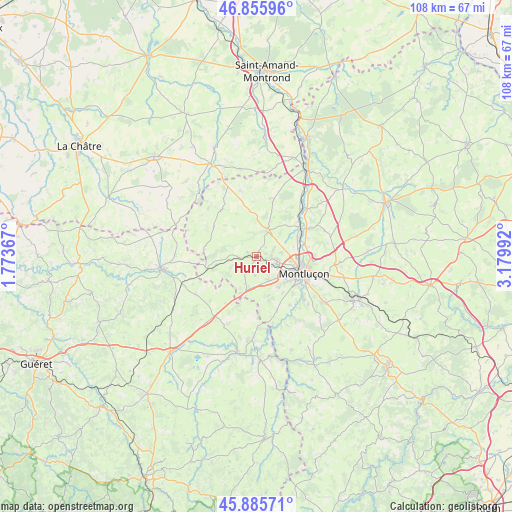
Huriel GPS coordinates[2]
46° 22' 22.764" North, 2° 28' 36.444" East
| Map corner | latitude | longitude |
|---|---|---|
| Upper-left | 46.85596°, | 1.77367° |
| Center: | 46.37299°, | 2.47679° |
| Lower-right: | 45.88571°, | 3.17992° |
| Map W x H: | 107.9×107.9 km | = 67×67mi |
| max Lat: | 51.07786° ⇑61.4% North |
| Huriel: | 46.37299° |
| min Lat: | ⇓38.6% South 41.3874° |
| min Long | Huriel | max Long |
| -5.08615° | 2.47679° | 9.52242° |
| W 50.2%⇐ | ⇒49.8% E |
Elevation
Elevation of Huriel is 327 m = 1073 ft, and this is 133.3 m = 437 ft above average elevation for this country.
| Max E: |
2333 m = 7654 ft | 16.6% |
| Huriel | 327 m 1073 ft | |
| Avg. | 193.7 m = 635 ft | |
Min E: |
-1 m = -3 ft | 83.4% |
See also: France elevation on elevation.city.
Geographical zone
Huriel is located in North temperate zone (between Tropic of Cancer and the Arctic Circle). Distance of this North polar circle is 2245 km =1395 mi to North.| Distance of | km | miles | from Huriel |
|---|---|---|---|
| North Pole | 4850.9 | 3014.2 | to North |
| Arctic Circle | 2245 | 1395 | to North |
| Tropic Cancer | 2550.3 | 1584.7 | to South |
| Equator | 5156.2 | 3203.9 | to South |


Nearby cities:
15 places around Huriel: (largest is in red/bold)
• Domérat
4.6 km =2.9 mi,  107°
107°
• Désertines
11.1 km =6.9 mi,  100°
100°
• Estivareilles
12.3 km =7.6 mi,  61°
61°
• La Chapelaude
5.6 km =3.5 mi,  22°
22°
• Lavault-Sainte-Anne
11.8 km =7.3 mi,  126°
126°
• Lignerolles
12.4 km =7.7 mi,  146°
146°
• Montluçon
10.3 km =6.4 mi, 110°
• Néris-les-Bains
16.9 km =10.5 mi,  124°
124°
• Prémilhat
8 km =5 mi, 145°
• Quinssaines
5.7 km =3.5 mi, 153°
• Saint-Martinien
4.2 km =2.6 mi,  186°
186°
• Saint-Victor
10.4 km =6.5 mi,  76°
76°
• Soumans
15.3 km =9.5 mi,  238°
238°
• Vallière
12.5 km =7.8 mi, 191°
• Verneix
15.1 km =9.4 mi, 79°
Sources, notices
• [Note1] Compared only with cities in France existing in our database
• [Src1] Map data: © OpenStreetMap contributors (CC-BY-SA)
• [Src2] Other city data from geonames.org with taken over terms of usage.
• [Src3] Geographical zone / Annual Mean Temperature by Robert A. Rohde @ Wikipedia
