Saint-Martinien geodata
Saint-Martinien (Auvergne-Rhône-Alpes) is a populated place; located in France in Europe/Paris (GMT+2) time zone. With population of 532 people, there are 14567 cities with bigger population in this country. Compared to other cities in France, 61.8% of cities are located further ↑North; 50.1% of cities are located further ←West and 88.3% of cities have lower elevation than Saint-Martinien. Note1
Administrative division(s):
- Level 1: Auvergne-Rhône-Alpes
- Level 2: Département de l'Allier
- Level 3: Arrondissement de Montluçon
- Level 4: Saint-Martinien


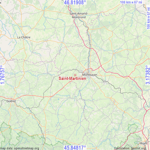
Saint-Martinien GPS coordinates[2]
46° 20' 8.808" North, 2° 28' 14.52" East
| Map corner | latitude | longitude |
|---|---|---|
| Upper-left | 46.81908°, | 1.76757° |
| Center: | 46.33578°, | 2.4707° |
| Lower-right: | 45.84817°, | 3.17382° |
| Map W x H: | 108×108 km | = 67.1×67.1mi |
| max Lat: | 51.07786° ⇑61.8% North |
| Saint-Martinien: | 46.33578° |
| min Lat: | ⇓38.2% South 41.3874° |
| min Long | Saint-Martinien | max Long |
| -5.08615° | 2.4707° | 9.52242° |
| W 50.1%⇐ | ⇒49.9% E |
Elevation
Elevation of Saint-Martinien is 394 m = 1293 ft, and this is 200.3 m = 657 ft above average elevation for this country.
| Max E: |
2333 m = 7654 ft | 11.7% |
| Saint-Martinien | 394 m 1293 ft | |
| Avg. | 193.7 m = 635 ft | |
Min E: |
-1 m = -3 ft | 88.3% |
See also: France elevation on elevation.city.
Geographical zone
Saint-Martinien is located in North temperate zone (between Tropic of Cancer and the Arctic Circle). Distance of this North polar circle is 2249.1 km =1397.5 mi to North.| Distance of | km | miles | from Saint-Martinien |
|---|---|---|---|
| North Pole | 4855 | 3016.8 | to North |
| Arctic Circle | 2249.1 | 1397.5 | to North |
| Tropic Cancer | 2546.1 | 1582.1 | to South |
| Equator | 5152.1 | 3201.4 | to South |


Nearby cities:
15 places around Saint-Martinien: (largest is in red/bold)
• Budelière
12.8 km =8 mi,  180°
180°
• Domérat
5.6 km =3.5 mi,  60°
60°
• Désertines
11.6 km =7.2 mi,  79°
79°
• Estivareilles
15.1 km =9.4 mi,  48°
48°
• Huriel
4.2 km =2.6 mi,  6°
6°
• La Chapelaude
9.7 km =6 mi,  15°
15°
• Lavault-Sainte-Anne
10.4 km =6.5 mi,  106°
106°
• Lignerolles
9.6 km =6 mi,  130°
130°
• Montluçon
10.1 km =6.3 mi,  87°
87°
• Prémilhat
5.6 km =3.5 mi,  116°
116°
• Quinssaines
3.2 km =2 mi, 107°
• Saint-Victor
12.4 km =7.7 mi, 58°
• Soumans
13.2 km =8.2 mi,  253°
253°
• Vallière
8.4 km =5.2 mi,  193°
193°
• Villebret
15 km =9.3 mi, 120°
Sources, notices
• [Note1] Compared only with cities in France existing in our database
• [Src1] Map data: © OpenStreetMap contributors (CC-BY-SA)
• [Src2] Other city data from geonames.org with taken over terms of usage.
• [Src3] Geographical zone / Annual Mean Temperature by Robert A. Rohde @ Wikipedia
