Hombleux geodata
Hombleux (Hauts-de-France) is a populated place; located in France in Europe/Paris (GMT+2) time zone. With population of 1,043 people, there are 8513 cities with bigger population in this country. Compared to other cities in France, 91.9% of cities are located further ↓South; 57.6% of cities are located further ←West and 75.8% of cities have higher elevation than Hombleux. Note1
Administrative division(s):
- Level 1: Hauts-de-France
- Level 2: Somme
- Level 3: Arrondissement de Péronne
- Level 4: Hombleux


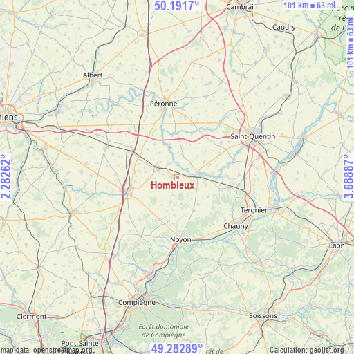
Hombleux GPS coordinates[2]
49° 44' 21.912" North, 2° 59' 8.664" East
| Map corner | latitude | longitude |
|---|---|---|
| Upper-left | 50.1917°, | 2.28262° |
| Center: | 49.73942°, | 2.98574° |
| Lower-right: | 49.28289°, | 3.68887° |
| Map W x H: | 101.1×101 km | = 62.8×62.8mi |
| max Lat: | 51.07786° ⇑8.1% North |
| Hombleux: | 49.73942° |
| min Lat: | ⇓91.9% South 41.3874° |
| min Long | Hombleux | max Long |
| -5.08615° | 2.98574° | 9.52242° |
| W 57.6%⇐ | ⇒42.4% E |
Elevation
Elevation of Hombleux is 65 m = 213 ft, and this is 128.7 m = 422 ft below average elevation for this country.
| Max E: |
2333 m = 7654 ft | 75.8% |
| Avg. | 193.7 m = 635 ft | |
| Hombleux | 65 m = 213 ft | |
Min E: |
-1 m = -3 ft | 24.2% |
See also: France elevation on elevation.city.
Geographical zone
Hombleux is located in North temperate zone (between Tropic of Cancer and the Arctic Circle). Distance of this North polar circle is 1870.7 km =1162.4 mi to North.| Distance of | km | miles | from Hombleux |
|---|---|---|---|
| North Pole | 4476.6 | 2781.6 | to North |
| Arctic Circle | 1870.7 | 1162.4 | to North |
| Tropic Cancer | 2924.6 | 1817.3 | to South |
| Equator | 5530.5 | 3436.5 | to South |


Nearby cities:
15 places around Hombleux: (largest is in red/bold)
• Athies
12.7 km =7.9 mi,  359°
359°
• Beaulieu-les-Fontaines
10.3 km =6.4 mi,  210°
210°
• Brouchy
8.6 km =5.3 mi,  107°
107°
• Cugny
12.5 km =7.8 mi, 106°
• Eppeville
4.7 km =2.9 mi,  88°
88°
• Ercheu
5.2 km =3.2 mi,  217°
217°
• Esmery-Hallon
3.2 km =2 mi,  141°
141°
• Guiscard
10.3 km =6.4 mi,  152°
152°
• Ham
6.3 km =3.9 mi,  82°
82°
• Matigny
6.5 km =4 mi,  13°
13°
• Mesnil-Saint-Nicaise
6.4 km =4 mi,  312°
312°
• Muille-Villette
6 km =3.7 mi,  102°
102°
• Muirancourt
10.7 km =6.6 mi,  170°
170°
• Nesle
5.8 km =3.6 mi,  292°
292°
• Voyennes
3.5 km =2.2 mi,  0°
0°
Sources, notices
• [Note1] Compared only with cities in France existing in our database
• [Src1] Map data: © OpenStreetMap contributors (CC-BY-SA)
• [Src2] Other city data from geonames.org with taken over terms of usage.
• [Src3] Geographical zone / Annual Mean Temperature by Robert A. Rohde @ Wikipedia
