Ercheu geodata
Ercheu (Hauts-de-France) is a populated place; located in France in Europe/Paris (GMT+2) time zone. With population of 719 people, there are 11547 cities with bigger population in this country. Compared to other cities in France, 91.6% of cities are located further ↓South; 57% of cities are located further ←West and 74.1% of cities have higher elevation than Ercheu. Note1
Administrative division(s):
- Level 1: Hauts-de-France
- Level 2: Somme
- Level 3: Arrondissement de Montdidier
- Level 4: Ercheu


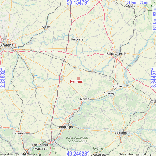
Ercheu GPS coordinates[2]
49° 42' 7.776" North, 2° 56' 29.22" East
| Map corner | latitude | longitude |
|---|---|---|
| Upper-left | 50.15479°, | 2.23832° |
| Center: | 49.70216°, | 2.94145° |
| Lower-right: | 49.24528°, | 3.64457° |
| Map W x H: | 101.1×101.1 km | = 62.8×62.8mi |
| max Lat: | 51.07786° ⇑8.4% North |
| Ercheu: | 49.70216° |
| min Lat: | ⇓91.6% South 41.3874° |
| min Long | Ercheu | max Long |
| -5.08615° | 2.94145° | 9.52242° |
| W 57%⇐ | ⇒43% E |
Elevation
Elevation of Ercheu is 69 m = 226 ft, and this is 124.7 m = 409 ft below average elevation for this country.
| Max E: |
2333 m = 7654 ft | 74.1% |
| Avg. | 193.7 m = 635 ft | |
| Ercheu | 69 m = 226 ft | |
Min E: |
-1 m = -3 ft | 25.9% |
See also: France elevation on elevation.city.
Geographical zone
Ercheu is located in North temperate zone (between Tropic of Cancer and the Arctic Circle). Distance of this North polar circle is 1874.8 km =1164.9 mi to North.| Distance of | km | miles | from Ercheu |
|---|---|---|---|
| North Pole | 4480.7 | 2784.2 | to North |
| Arctic Circle | 1874.8 | 1164.9 | to North |
| Tropic Cancer | 2920.4 | 1814.7 | to South |
| Equator | 5526.4 | 3433.9 | to South |


Nearby cities:
15 places around Ercheu: (largest is in red/bold)
• Beaulieu-les-Fontaines
5.1 km =3.2 mi,  204°
204°
• Crisolles
10.3 km =6.4 mi,  149°
149°
• Eppeville
9 km =5.6 mi,  61°
61°
• Esmery-Hallon
5.4 km =3.4 mi,  72°
72°
• Genvry
10.7 km =6.6 mi,  160°
160°
• Guiscard
9.4 km =5.8 mi,  122°
122°
• Ham
10.7 km =6.6 mi, 62°
• Hombleux
5.2 km =3.2 mi,  37°
37°
• Matigny
11.5 km =7.1 mi,  24°
24°
• Mesnil-Saint-Nicaise
8.6 km =5.3 mi,  349°
349°
• Muille-Villette
9.5 km =5.9 mi, 72°
• Muirancourt
8.1 km =5 mi,  142°
142°
• Nesle
6.7 km =4.2 mi,  341°
341°
• Roye
10.9 km =6.8 mi,  268°
268°
• Voyennes
8.3 km =5.2 mi, 22°
Sources, notices
• [Note1] Compared only with cities in France existing in our database
• [Src1] Map data: © OpenStreetMap contributors (CC-BY-SA)
• [Src2] Other city data from geonames.org with taken over terms of usage.
• [Src3] Geographical zone / Annual Mean Temperature by Robert A. Rohde @ Wikipedia
