Châtenois-les-Forges geodata
Châtenois-les-Forges (Bourgogne-Franche-Comté) is a populated place; located in France in Europe/Paris (GMT+2) time zone. With population of 2,798 people, there are 3484 cities with bigger population in this country. Compared to other cities in France, 52.1% of cities are located further ↓South; 93.9% of cities are located further ←West and 83.8% of cities have lower elevation than Châtenois-les-Forges. Note1
Administrative division(s):
- Level 1: Bourgogne-Franche-Comté
- Level 2: Territoire de Belfort
- Level 3: Arrondissement de Belfort
- Level 4: Châtenois-les-Forges
Current local time in Châtenois-les-Forges:
05:51 AM, WednesdayDifference from your time zone: hours


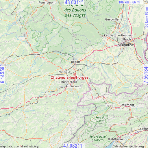
Châtenois-les-Forges GPS coordinates[2]
47° 33' 31.5" North, 6° 50' 55.356" East
| Map corner | latitude | longitude |
|---|---|---|
| Upper-left | 48.0311°, | 6.14559° |
| Center: | 47.55875°, | 6.84871° |
| Lower-right: | 47.08211°, | 7.55184° |
| Map W x H: | 105.5×105.5 km | = 65.6×65.6mi |
| max Lat: | 51.07786° ⇑47.9% North |
| Châtenois-les-Forges: | 47.55875° |
| min Lat: | ⇓52.1% South 41.3874° |
| min Long | Châtenois-les- | max Long |
| -5.08615° | 6.84871° | 9.52242° |
| W 93.9%⇐ | ⇒6.1% E |
Elevation
Elevation of Châtenois-les-Forges is 332 m = 1089 ft, and this is 138.3 m = 454 ft above average elevation for this country.
| Max E: |
2333 m = 7654 ft | 16.2% |
| Châtenois-les-Forges | 332 m 1089 ft | |
| Avg. | 193.7 m = 635 ft | |
Min E: |
-1 m = -3 ft | 83.8% |
See also: France elevation on elevation.city.
Geographical zone
Châtenois-les-Forges is located in North temperate zone (between Tropic of Cancer and the Arctic Circle). Distance of this North polar circle is 2113.1 km =1313 mi to North.| Distance of | km | miles | from Châtenois-les-Forges |
|---|---|---|---|
| North Pole | 4719 | 2932.2 | to North |
| Arctic Circle | 2113.1 | 1313 | to North |
| Tropic Cancer | 2682.1 | 1666.6 | to South |
| Equator | 5288 | 3285.8 | to South |


Nearby cities:
15 places around Châtenois-les-Forges: (largest is in red/bold)
• Allenjoie
4.5 km =2.8 mi,  125°
125°
• Andelnans
5.1 km =3.2 mi,  15°
15°
• Bethoncourt
4.2 km =2.6 mi,  231°
231°
• Bourogne
5.1 km =3.2 mi,  84°
84°
• Brevilliers
5.1 km =3.2 mi,  300°
300°
• Dambenois
2.1 km =1.3 mi,  136°
136°
• Dorans
3.4 km =2.1 mi,  346°
346°
• Fesches-le-Châtel
5.7 km =3.5 mi, 132°
• Grand-Charmont
3.9 km =2.4 mi,  205°
205°
• Meroux
5.6 km =3.5 mi,  42°
42°
• Méziré
6.1 km =3.8 mi,  117°
117°
• Nommay
2.4 km =1.5 mi,  191°
191°
• Sevenans
3.4 km =2.1 mi, 22°
• Sochaux
5.9 km =3.7 mi,  195°
195°
• Vieux-Charmont
4.2 km =2.6 mi, 191°
Sources, notices
• [Note1] Compared only with cities in France existing in our database
• [Src1] Map data: © OpenStreetMap contributors (CC-BY-SA)
• [Src2] Other city data from geonames.org with taken over terms of usage.
• [Src3] Geographical zone / Annual Mean Temperature by Robert A. Rohde @ Wikipedia
