Hautefort geodata
Hautefort (Nouvelle-Aquitaine) is a populated place; located in France in Europe/Paris (GMT+2) time zone. With population of 1,244 people, there are 7311 cities with bigger population in this country. Compared to other cities in France, 76.8% of cities are located further ↑North; 67.4% of cities are located further →East and 67% of cities have lower elevation than Hautefort. Note1
Administrative division(s):
- Level 1: Nouvelle-Aquitaine
- Level 2: Dordogne
- Level 3: Arrondissement de Sarlat-la-Canéda
- Level 4: Hautefort


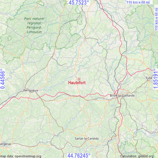
Hautefort GPS coordinates[2]
45° 15' 34.308" North, 1° 8' 55.644" East
| Map corner | latitude | longitude |
|---|---|---|
| Upper-left | 45.7523°, | 0.44566° |
| Center: | 45.25953°, | 1.14879° |
| Lower-right: | 44.76245°, | 1.85191° |
| Map W x H: | 110.1×110.1 km | = 68.4×68.4mi |
| max Lat: | 51.07786° ⇑76.8% North |
| Hautefort: | 45.25953° |
| min Lat: | ⇓23.2% South 41.3874° |
| min Long | Hautefort | max Long |
| -5.08615° | 1.14879° | 9.52242° |
| W 32.6%⇐ | ⇒67.4% E |
Elevation
Elevation of Hautefort is 204 m = 669 ft, and this is 10.3 m = 34 ft above average elevation for this country.
| Max E: |
2333 m = 7654 ft | 33% |
| Hautefort | 204 m 669 ft | |
| Avg. | 193.7 m = 635 ft | |
Min E: |
-1 m = -3 ft | 67% |
See also: France elevation on elevation.city.
Geographical zone
Hautefort is located in North temperate zone (between Tropic of Cancer and the Arctic Circle). Distance of this North polar circle is 2368.8 km =1471.9 mi to North.| Distance of | km | miles | from Hautefort |
|---|---|---|---|
| North Pole | 4974.7 | 3091.1 | to North |
| Arctic Circle | 2368.8 | 1471.9 | to North |
| Tropic Cancer | 2426.5 | 1507.8 | to South |
| Equator | 5032.4 | 3127 | to South |


Nearby cities:
15 places around Hautefort: (largest is in red/bold)
• Ayen
14 km =8.7 mi,  95°
95°
• Beauregard-de-Terrasson
13.9 km =8.6 mi,  152°
152°
• Cherveix-Cubas
4.3 km =2.7 mi,  322°
322°
• Coulaures
14.2 km =8.8 mi,  291°
291°
• Excideuil
11.6 km =7.2 mi, 317°
• Génis
7.4 km =4.6 mi,  8°
8°
• Juillac
15.1 km =9.4 mi,  64°
64°
• Lanouaille
15.1 km =9.4 mi,  357°
357°
• Le Lardin-Saint-Lazare
15 km =9.3 mi,  159°
159°
• Payzac
16.5 km =10.3 mi,  18°
18°
• Saint-Rabier
9.7 km =6 mi,  179°
179°
• Salagnac
6.9 km =4.3 mi,  33°
33°
• Savignac-Lédrier
12.9 km =8 mi, 25°
• Thenon
14.7 km =9.1 mi,  204°
204°
• Tourtoirac
7.1 km =4.4 mi,  279°
279°
Sources, notices
• [Note1] Compared only with cities in France existing in our database
• [Src1] Map data: © OpenStreetMap contributors (CC-BY-SA)
• [Src2] Other city data from geonames.org with taken over terms of usage.
• [Src3] Geographical zone / Annual Mean Temperature by Robert A. Rohde @ Wikipedia
