Moineville geodata
Moineville (Grand Est) is a populated place; located in France in Europe/Paris (GMT+2) time zone. With population of 899 people, there are 9669 cities with bigger population in this country. Compared to other cities in France, 84.4% of cities are located further ↓South; 86.5% of cities are located further ←West and 69.8% of cities have lower elevation than Moineville. Note1
Administrative division(s):
- Level 1: Grand Est
- Level 2: Meurthe-et-Moselle
- Level 3: Arrondissement de Briey
- Level 4: Moineville


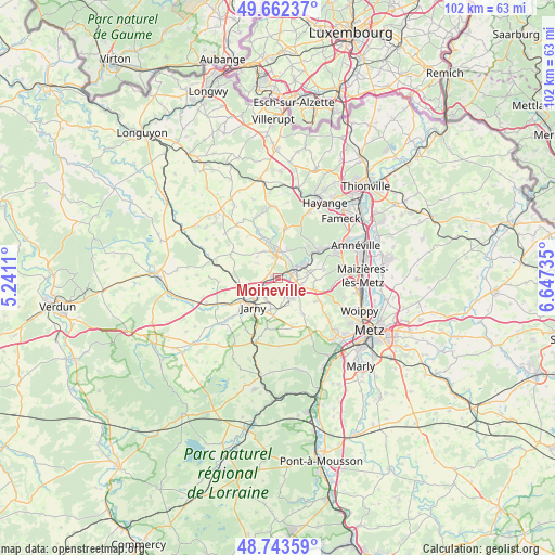
Moineville GPS coordinates[2]
49° 12' 18.396" North, 5° 56' 39.192" East
| Map corner | latitude | longitude |
|---|---|---|
| Upper-left | 49.66237°, | 5.2411° |
| Center: | 49.20511°, | 5.94422° |
| Lower-right: | 48.74359°, | 6.64735° |
| Map W x H: | 102.2×102.2 km | = 63.5×63.5mi |
| max Lat: | 51.07786° ⇑15.6% North |
| Moineville: | 49.20511° |
| min Lat: | ⇓84.4% South 41.3874° |
| min Long | Moineville | max Long |
| -5.08615° | 5.94422° | 9.52242° |
| W 86.5%⇐ | ⇒13.5% E |
Elevation
Elevation of Moineville is 218 m = 715 ft, and this is 24.3 m = 80 ft above average elevation for this country.
| Max E: |
2333 m = 7654 ft | 30.2% |
| Moineville | 218 m 715 ft | |
| Avg. | 193.7 m = 635 ft | |
Min E: |
-1 m = -3 ft | 69.8% |
See also: France elevation on elevation.city.
Geographical zone
Moineville is located in North temperate zone (between Tropic of Cancer and the Arctic Circle). Distance of this North polar circle is 1930.1 km =1199.3 mi to North.| Distance of | km | miles | from Moineville |
|---|---|---|---|
| North Pole | 4536 | 2818.5 | to North |
| Arctic Circle | 1930.1 | 1199.3 | to North |
| Tropic Cancer | 2865.2 | 1780.4 | to South |
| Equator | 5471.1 | 3399.6 | to South |


Nearby cities:
15 places around Moineville: (largest is in red/bold)
• Auboué
2.5 km =1.6 mi,  72°
72°
• Batilly
3.9 km =2.4 mi,  153°
153°
• Briey
4.9 km =3 mi,  356°
356°
• Doncourt-lès-Conflans
7 km =4.3 mi,  186°
186°
• Giraumont
4.4 km =2.7 mi,  209°
209°
• Hatrize
2.9 km =1.8 mi,  240°
240°
• Homécourt
3.9 km =2.4 mi,  63°
63°
• Jœuf
6.1 km =3.8 mi, 59°
• Labry
5.8 km =3.6 mi,  232°
232°
• Lantéfontaine
5.7 km =3.5 mi,  330°
330°
• Montois-la-Montagne
5.8 km =3.6 mi,  76°
76°
• Moutiers
3.5 km =2.2 mi,  26°
26°
• Roncourt
7 km =4.3 mi,  92°
92°
• Sainte-Marie-aux-Chênes
4.4 km =2.7 mi,  108°
108°
• Valleroy
0.7 km =0.4 mi,  312°
312°
Sources, notices
• [Note1] Compared only with cities in France existing in our database
• [Src1] Map data: © OpenStreetMap contributors (CC-BY-SA)
• [Src2] Other city data from geonames.org with taken over terms of usage.
• [Src3] Geographical zone / Annual Mean Temperature by Robert A. Rohde @ Wikipedia
