Ernolsheim-lès-Saverne geodata
Ernolsheim-lès-Saverne (Grand Est) is a populated place; located in France in Europe/Paris (GMT+2) time zone. With population of 626 people, there are 12883 cities with bigger population in this country. Compared to other cities in France, 75.4% of cities are located further ↓South; 97.1% of cities are located further ←West and 71.7% of cities have lower elevation than Ernolsheim-lès-Saverne. Note1
Administrative division(s):
- Level 1: Grand Est
- Level 2: Bas-Rhin
- Level 3: Arrondissement de Saverne
- Level 4: Ernolsheim-lès-Saverne


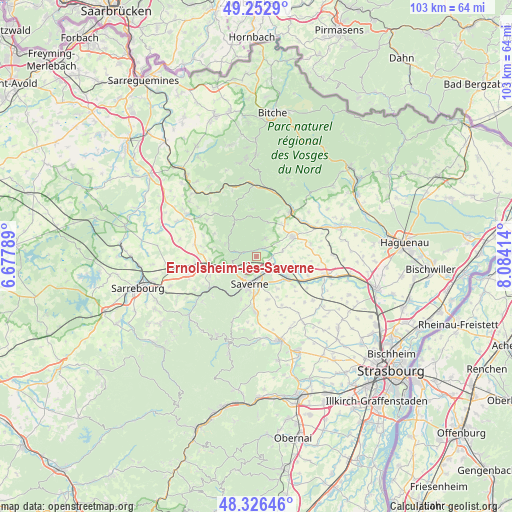
Ernolsheim-lès-Saverne GPS coordinates[2]
48° 47' 30.552" North, 7° 22' 51.636" East
| Map corner | latitude | longitude |
|---|---|---|
| Upper-left | 49.2529°, | 6.67789° |
| Center: | 48.79182°, | 7.38101° |
| Lower-right: | 48.32646°, | 8.08414° |
| Map W x H: | 103×103 km | = 64×64mi |
| max Lat: | 51.07786° ⇑24.6% North |
| Ernolsheim-lès-Saverne: | 48.79182° |
| min Lat: | ⇓75.4% South 41.3874° |
| min Long | Ernolsheim-lès | max Long |
| -5.08615° | 7.38101° | 9.52242° |
| W 97.1%⇐ | ⇒2.9% E |
Elevation
Elevation of Ernolsheim-lès-Saverne is 228 m = 748 ft, and this is 34.3 m = 113 ft above average elevation for this country.
| Max E: |
2333 m = 7654 ft | 28.3% |
| Ernolsheim-lès-Saverne | 228 m 748 ft | |
| Avg. | 193.7 m = 635 ft | |
Min E: |
-1 m = -3 ft | 71.7% |
See also: France elevation on elevation.city.
Geographical zone
Ernolsheim-lès-Saverne is located in North temperate zone (between Tropic of Cancer and the Arctic Circle). Distance of this North polar circle is 1976 km =1227.8 mi to North.| Distance of | km | miles | from Ernolsheim-lès-Saverne |
|---|---|---|---|
| North Pole | 4581.9 | 2847.1 | to North |
| Arctic Circle | 1976 | 1227.8 | to North |
| Tropic Cancer | 2819.2 | 1751.8 | to South |
| Equator | 5425.1 | 3371 | to South |


Nearby cities:
15 places around Ernolsheim-lès-Saverne: (largest is in red/bold)
• Bouxwiller
8.2 km =5.1 mi,  63°
63°
• Danne
7.1 km =4.4 mi,  243°
243°
• Dettwiller
7.5 km =4.7 mi,  123°
123°
• Dossenheim-sur-Zinsel
2.2 km =1.4 mi,  45°
45°
• Eschbourg
6.7 km =4.2 mi,  291°
291°
• Hattmatt
3 km =1.9 mi,  92°
92°
• Monswiller
4.1 km =2.5 mi,  183°
183°
• Neuwiller-lès-Saverne
4.1 km =2.5 mi,  25°
25°
• Ottersthal
4.7 km =2.9 mi,  208°
208°
• Otterswiller
7.4 km =4.6 mi, 181°
• Saint-Jean-Saverne
2.8 km =1.7 mi, 210°
• Saverne
5.7 km =3.5 mi,  193°
193°
• Steinbourg
3.4 km =2.1 mi,  135°
135°
• Waldolwisheim
7.7 km =4.8 mi,  147°
147°
• Weiterswiller
7.3 km =4.5 mi,  17°
17°
Sources, notices
• [Note1] Compared only with cities in France existing in our database
• [Src1] Map data: © OpenStreetMap contributors (CC-BY-SA)
• [Src2] Other city data from geonames.org with taken over terms of usage.
• [Src3] Geographical zone / Annual Mean Temperature by Robert A. Rohde @ Wikipedia
