Somme-Suippe geodata
Somme-Suippe (Grand Est) is a populated place; located in France in Europe/Paris (GMT+2) time zone. With population of 668 people, there are 12251 cities with bigger population in this country. Compared to other cities in France, 82.5% of cities are located further ↓South; 72.6% of cities are located further ←West and 52.8% of cities have lower elevation than Somme-Suippe. Note1
Administrative division(s):
- Level 1: Grand Est
- Level 2: Marne
- Level 3: Arrondissement de Châlons-en-Champagne
- Level 4: Somme-Suippe


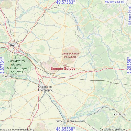
Somme-Suippe GPS coordinates[2]
49° 6' 56.664" North, 4° 34' 49.548" East
| Map corner | latitude | longitude |
|---|---|---|
| Upper-left | 49.57383°, | 3.87731° |
| Center: | 49.11574°, | 4.58043° |
| Lower-right: | 48.65338°, | 5.28356° |
| Map W x H: | 102.3×102.3 km | = 63.6×63.6mi |
| max Lat: | 51.07786° ⇑17.5% North |
| Somme-Suippe: | 49.11574° |
| min Lat: | ⇓82.5% South 41.3874° |
| min Long | Somme-Suippe | max Long |
| -5.08615° | 4.58043° | 9.52242° |
| W 72.6%⇐ | ⇒27.4% E |
Elevation
Elevation of Somme-Suippe is 142 m = 466 ft, and this is 51.7 m = 170 ft below average elevation for this country.
| Max E: |
2333 m = 7654 ft | 47.2% |
| Avg. | 193.7 m = 635 ft | |
| Somme-Suippe | 142 m = 466 ft | |
Min E: |
-1 m = -3 ft | 52.8% |
See also: France elevation on elevation.city.
Geographical zone
Somme-Suippe is located in North temperate zone (between Tropic of Cancer and the Arctic Circle). Distance of this North polar circle is 1940 km =1205.5 mi to North.| Distance of | km | miles | from Somme-Suippe |
|---|---|---|---|
| North Pole | 4545.9 | 2824.7 | to North |
| Arctic Circle | 1940 | 1205.5 | to North |
| Tropic Cancer | 2855.2 | 1774.1 | to South |
| Equator | 5461.2 | 3393.4 | to South |


Nearby cities:
15 places around Somme-Suippe: (largest is in red/bold)
• Châlons-en-Champagne
23.8 km =14.8 mi,  220°
220°
• Courtisols
15.1 km =9.4 mi,  197°
197°
• La Veuve
21.4 km =13.3 mi,  243°
243°
• Livry-Louvercy
20.5 km =12.7 mi,  265°
265°
• L’Épine
17.2 km =10.7 mi,  207°
207°
• Mourmelon-le-Grand
15.8 km =9.8 mi,  276°
276°
• Mourmelon-le-Petit
19.5 km =12.1 mi, 274°
• Recy
24 km =14.9 mi,  233°
233°
• Saint-Martin-sur-le-Pré
23.4 km =14.5 mi, 228°
• Saint-Memmie
23.1 km =14.4 mi, 218°
• Sainte-Menehould
23.2 km =14.4 mi,  97°
97°
• Sept-Saulx
24 km =14.9 mi, 278°
• Sommepy-Tahure
15.2 km =9.4 mi,  353°
353°
• Suippes
3.6 km =2.2 mi,  293°
293°
• Vienne-le-Château
23.8 km =14.8 mi,  69°
69°
Sources, notices
• [Note1] Compared only with cities in France existing in our database
• [Src1] Map data: © OpenStreetMap contributors (CC-BY-SA)
• [Src2] Other city data from geonames.org with taken over terms of usage.
• [Src3] Geographical zone / Annual Mean Temperature by Robert A. Rohde @ Wikipedia
