Givrand geodata
Givrand (Pays de la Loire) is a populated place; located in France in Europe/Paris (GMT+2) time zone. With population of 1,400 people, there are 6605 cities with bigger population in this country. Compared to other cities in France, 58.5% of cities are located further ↑North; 94.4% of cities are located further →East and 96.7% of cities have higher elevation than Givrand. Note1
Administrative division(s):
- Level 1: Pays de la Loire
- Level 2: Département de la Vendée
- Level 3: Arrondissement des Sables-d'Olonne
- Level 4: Givrand


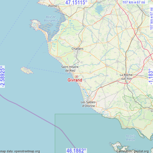
Givrand GPS coordinates[2]
46° 40' 14.988" North, 1° 53' 10.032" West
| Map corner | latitude | longitude |
|---|---|---|
| Upper-left | 47.15115°, | -2.58925° |
| Center: | 46.67083°, | -1.88612° |
| Lower-right: | 46.1862°, | -1.183° |
| Map W x H: | 107.3×107.3 km | = 66.7×66.7mi |
| max Lat: | 51.07786° ⇑58.5% North |
| Givrand: | 46.67083° |
| min Lat: | ⇓41.5% South 41.3874° |
| min Long | Givrand | max Long |
| -5.08615° | -1.88612° | 9.52242° |
| W 5.6%⇐ | ⇒94.4% E |
Elevation
Elevation of Givrand is 12 m = 39 ft, and this is 181.7 m = 596 ft below average elevation for this country.
| Max E: |
2333 m = 7654 ft | 96.7% |
| Avg. | 193.7 m = 635 ft | |
| Givrand | 12 m = 39 ft | |
Min E: |
-1 m = -3 ft | 3.3% |
See also: France elevation on elevation.city.
Geographical zone
Givrand is located in North temperate zone (between Tropic of Cancer and the Arctic Circle). Distance of this North polar circle is 2211.9 km =1374.4 mi to North.| Distance of | km | miles | from Givrand |
|---|---|---|---|
| North Pole | 4817.8 | 2993.6 | to North |
| Arctic Circle | 2211.9 | 1374.4 | to North |
| Tropic Cancer | 2583.4 | 1605.2 | to South |
| Equator | 5189.3 | 3224.5 | to South |


Nearby cities:
15 places around Givrand: (largest is in red/bold)
• Bretignolles-sur-Mer
4.4 km =2.7 mi,  160°
160°
• Commequiers
10.6 km =6.6 mi,  19°
19°
• Coëx
10.1 km =6.3 mi,  72°
72°
• La Chaize-Giraud
5.9 km =3.7 mi,  116°
116°
• La Chapelle-Hermier
12.6 km =7.8 mi,  84°
84°
• Landevieille
6.9 km =4.3 mi, 118°
• Le Fenouiller
5.5 km =3.4 mi,  347°
347°
• Notre-Dame-de-Riez
8.4 km =5.2 mi, 348°
• Saint-Gilles-Croix-de-Vie
5.4 km =3.4 mi,  303°
303°
• Saint-Hilaire-de-Riez
5.6 km =3.5 mi,  327°
327°
• Saint-Julien-des-Landes
13.6 km =8.5 mi,  104°
104°
• Saint-Maixent-sur-Vie
9 km =5.6 mi,  31°
31°
• Saint-Révérend
5.2 km =3.2 mi,  54°
54°
• Soullans
14 km =8.7 mi,  355°
355°
• Vairé
12.6 km =7.8 mi,  127°
127°
Sources, notices
• [Note1] Compared only with cities in France existing in our database
• [Src1] Map data: © OpenStreetMap contributors (CC-BY-SA)
• [Src2] Other city data from geonames.org with taken over terms of usage.
• [Src3] Geographical zone / Annual Mean Temperature by Robert A. Rohde @ Wikipedia
