Gillonnay geodata
Gillonnay (Auvergne-Rhône-Alpes) is a populated place; located in France in Europe/Paris (GMT+2) time zone. With population of 1,024 people, there are 8660 cities with bigger population in this country. Compared to other cities in France, 75.4% of cities are located further ↑North; 80.6% of cities are located further ←West and 89.3% of cities have lower elevation than Gillonnay. Note1
Administrative division(s):
- Level 1: Auvergne-Rhône-Alpes
- Level 2: Département de l'Isère
- Level 3: Arrondissement de Vienne
- Level 4: Gillonnay


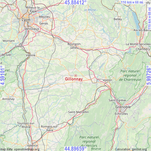
Gillonnay GPS coordinates[2]
45° 23' 33.036" North, 5° 17' 38.868" East
| Map corner | latitude | longitude |
|---|---|---|
| Upper-left | 45.88412°, | 4.59101° |
| Center: | 45.39251°, | 5.29413° |
| Lower-right: | 44.89659°, | 5.99726° |
| Map W x H: | 109.8×109.8 km | = 68.2×68.2mi |
| max Lat: | 51.07786° ⇑75.4% North |
| Gillonnay: | 45.39251° |
| min Lat: | ⇓24.6% South 41.3874° |
| min Long | Gillonnay | max Long |
| -5.08615° | 5.29413° | 9.52242° |
| W 80.6%⇐ | ⇒19.4% E |
Elevation
Elevation of Gillonnay is 411 m = 1348 ft, and this is 217.3 m = 713 ft above average elevation for this country.
| Max E: |
2333 m = 7654 ft | 10.7% |
| Gillonnay | 411 m 1348 ft | |
| Avg. | 193.7 m = 635 ft | |
Min E: |
-1 m = -3 ft | 89.3% |
See also: France elevation on elevation.city.
Geographical zone
Gillonnay is located in North temperate zone (between Tropic of Cancer and the Arctic Circle). Distance of this North polar circle is 2354 km =1462.7 mi to North.| Distance of | km | miles | from Gillonnay |
|---|---|---|---|
| North Pole | 4959.9 | 3081.9 | to North |
| Arctic Circle | 2354 | 1462.7 | to North |
| Tropic Cancer | 2441.3 | 1517 | to South |
| Equator | 5047.2 | 3136.2 | to South |


Nearby cities:
15 places around Gillonnay: (largest is in red/bold)
• Bizonnes
9.4 km =5.8 mi,  44°
44°
• Brézins
4.6 km =2.9 mi,  168°
168°
• Bévenais
7.8 km =4.8 mi,  86°
86°
• Champier
7 km =4.3 mi,  358°
358°
• Commelle
6.6 km =4.1 mi,  306°
306°
• La Côte-Saint-André
2.7 km =1.7 mi,  274°
274°
• La Frette
5.1 km =3.2 mi, 94°
• Le Grand-Lemps
9.8 km =6.1 mi, 87°
• Mottier
3.5 km =2.2 mi,  17°
17°
• Saint-Hilaire-de-la-Côte
1.7 km =1.1 mi, 93°
• Saint-Pierre-de-Bressieux
8.4 km =5.2 mi,  183°
183°
• Saint-Siméon-de-Bressieux
6.4 km =4 mi,  200°
200°
• Saint-Étienne-de-Saint-Geoirs
7.2 km =4.5 mi,  145°
145°
• Sardieu
7 km =4.3 mi,  247°
247°
• Sillans
9.2 km =5.7 mi,  126°
126°
Sources, notices
• [Note1] Compared only with cities in France existing in our database
• [Src1] Map data: © OpenStreetMap contributors (CC-BY-SA)
• [Src2] Other city data from geonames.org with taken over terms of usage.
• [Src3] Geographical zone / Annual Mean Temperature by Robert A. Rohde @ Wikipedia
