Ghisonaccia geodata
Ghisonaccia (Corsica) is a populated place; located in France in Europe/Paris (GMT+2) time zone. With population of 3,515 people, there are 2769 cities with bigger population in this country. Compared to other cities in France, 99.8% of cities are located further ↑North; 99.8% of cities are located further ←West and 95% of cities have higher elevation than Ghisonaccia. Note1
Administrative division(s):
- Level 1: Corsica
- Level 2: Département de la Haute-Corse
- Level 3: Arrondissement de Corte
- Level 4: Ghisonaccia


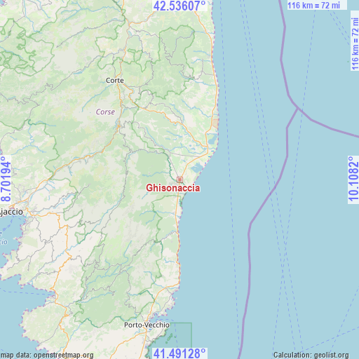
Ghisonaccia GPS coordinates[2]
42° 0' 56.952" North, 9° 24' 18.252" East
| Map corner | latitude | longitude |
|---|---|---|
| Upper-left | 42.53607°, | 8.70194° |
| Center: | 42.01582°, | 9.40507° |
| Lower-right: | 41.49128°, | 10.1082° |
| Map W x H: | 116.2×116.2 km | = 72.2×72.2mi |
| max Lat: | 51.07786° ⇑99.8% North |
| Ghisonaccia: | 42.01582° |
| min Lat: | ⇓0.2% South 41.3874° |
| min Long | Ghisonaccia | max Long |
| -5.08615° | 9.40507° | 9.52242° |
| W 99.8%⇐ | ⇒0.2% E |
Elevation
Elevation of Ghisonaccia is 17 m = 56 ft, and this is 176.7 m = 580 ft below average elevation for this country.
| Max E: |
2333 m = 7654 ft | 95% |
| Avg. | 193.7 m = 635 ft | |
| Ghisonaccia | 17 m = 56 ft | |
Min E: |
-1 m = -3 ft | 5% |
See also: France elevation on elevation.city.
Geographical zone
Ghisonaccia is located in North temperate zone (between Tropic of Cancer and the Arctic Circle). Distance of this Northern Tropic circle is 2065.8 km =1283.6 mi to South.| Distance of | km | miles | from Ghisonaccia |
|---|---|---|---|
| North Pole | 5335.3 | 3315.2 | to North |
| Arctic Circle | 2729.5 | 1696 | to North |
| Tropic Cancer | 2065.8 | 1283.6 | to South |
| Equator | 4671.7 | 2902.9 | to South |


Nearby cities:
15 places around Ghisonaccia: (largest is in red/bold)
• Aléria
13.3 km =8.3 mi,  42°
42°
• Bastelica
29 km =18 mi,  267°
267°
• Casevecchie
13.8 km =8.6 mi,  340°
340°
• Cervione
35.5 km =22.1 mi,  11°
11°
• Conca
31.9 km =19.8 mi,  190°
190°
• Linguizzetta
28.1 km =17.5 mi, 11°
• Poggio-di-Venaco
32.4 km =20.1 mi,  326°
326°
• Prunelli-di-Fiumorbo
6.7 km =4.2 mi,  264°
264°
• San-Giuliano
34.2 km =21.3 mi,  15°
15°
• Sari-Solenzara
20.2 km =12.6 mi, 187°
• Solaro
14 km =8.7 mi,  207°
207°
• Venaco
30.8 km =19.1 mi,  321°
321°
• Ventiseri
10 km =6.2 mi,  216°
216°
• Vivario
25.9 km =16.1 mi,  311°
311°
• Zonza
35.4 km =22 mi, 213°
Sources, notices
• [Note1] Compared only with cities in France existing in our database
• [Src1] Map data: © OpenStreetMap contributors (CC-BY-SA)
• [Src2] Other city data from geonames.org with taken over terms of usage.
• [Src3] Geographical zone / Annual Mean Temperature by Robert A. Rohde @ Wikipedia
