Ventiseri geodata
Ventiseri (Corsica) is a populated place; located in France in Europe/Paris (GMT+2) time zone. With population of 2,652 people, there are 3671 cities with bigger population in this country. Compared to other cities in France, 99.9% of cities are located further ↑North; 99.8% of cities are located further ←West and 89.8% of cities have lower elevation than Ventiseri. Note1
Administrative division(s):
- Level 1: Corsica
- Level 2: Département de la Haute-Corse
- Level 3: Arrondissement de Corte
- Level 4: Ventiseri


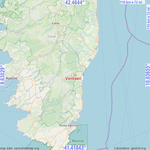
Ventiseri GPS coordinates[2]
41° 56' 36.816" North, 9° 20' 0.312" East
| Map corner | latitude | longitude |
|---|---|---|
| Upper-left | 42.4644°, | 8.63029° |
| Center: | 41.94356°, | 9.33342° |
| Lower-right: | 41.41843°, | 10.03655° |
| Map W x H: | 116.3×116.3 km | = 72.3×72.3mi |
| max Lat: | 51.07786° ⇑99.9% North |
| Ventiseri: | 41.94356° |
| min Lat: | ⇓0.1% South 41.3874° |
| min Long | Ventiseri | max Long |
| -5.08615° | 9.33342° | 9.52242° |
| W 99.8%⇐ | ⇒0.2% E |
Elevation
Elevation of Ventiseri is 423 m = 1388 ft, and this is 229.3 m = 752 ft above average elevation for this country.
| Max E: |
2333 m = 7654 ft | 10.2% |
| Ventiseri | 423 m 1388 ft | |
| Avg. | 193.7 m = 635 ft | |
Min E: |
-1 m = -3 ft | 89.8% |
See also: France elevation on elevation.city.
Geographical zone
Ventiseri is located in North temperate zone (between Tropic of Cancer and the Arctic Circle). Distance of this Northern Tropic circle is 2057.8 km =1278.7 mi to South.| Distance of | km | miles | from Ventiseri |
|---|---|---|---|
| North Pole | 5343.4 | 3320.2 | to North |
| Arctic Circle | 2737.5 | 1701 | to North |
| Tropic Cancer | 2057.8 | 1278.7 | to South |
| Equator | 4663.7 | 2897.9 | to South |


Nearby cities:
15 places around Ventiseri: (largest is in red/bold)
• Albitreccia
33.6 km =20.9 mi,  254°
254°
• Aléria
23.2 km =14.4 mi,  39°
39°
• Bastelica
24 km =14.9 mi,  286°
286°
• Casevecchie
21.1 km =13.1 mi,  3°
3°
• Conca
23.2 km =14.4 mi,  180°
180°
• Ghisonaccia
10 km =6.2 mi, 36°
• Grosseto-Prugna
31.6 km =19.6 mi,  255°
255°
• Levie
31.9 km =19.8 mi,  212°
212°
• Petreto
34.2 km =21.3 mi,  238°
238°
• Prunelli-di-Fiumorbo
7.5 km =4.7 mi,  354°
354°
• San-Gavino-di-Carbini
29.1 km =18.1 mi, 211°
• Sari-Solenzara
12.5 km =7.8 mi,  164°
164°
• Solaro
4.4 km =2.7 mi,  186°
186°
• Vivario
28.7 km =17.8 mi,  332°
332°
• Zonza
25.5 km =15.8 mi, 211°
Sources, notices
• [Note1] Compared only with cities in France existing in our database
• [Src1] Map data: © OpenStreetMap contributors (CC-BY-SA)
• [Src2] Other city data from geonames.org with taken over terms of usage.
• [Src3] Geographical zone / Annual Mean Temperature by Robert A. Rohde @ Wikipedia
