Fréland geodata
Fréland (Grand Est) is a populated place; located in France in Europe/Paris (GMT+2) time zone. With population of 1,371 people, there are 6723 cities with bigger population in this country. Compared to other cities in France, 62.3% of cities are located further ↓South; 95.8% of cities are located further ←West and 90.3% of cities have lower elevation than Fréland. Note1
Administrative division(s):
- Level 1: Grand Est
- Level 2: Haut-Rhin
- Level 3: Arrondissement de Colmar-Ribeauvillé
- Level 4: Fréland


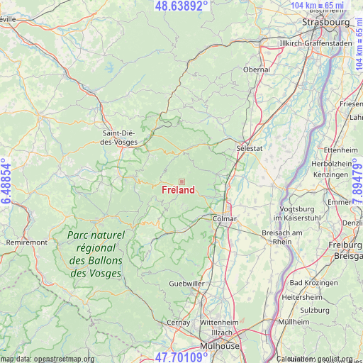
Fréland GPS coordinates[2]
48° 10' 19.74" North, 7° 11' 30.012" East
| Map corner | latitude | longitude |
|---|---|---|
| Upper-left | 48.63892°, | 6.48854° |
| Center: | 48.17215°, | 7.19167° |
| Lower-right: | 47.70109°, | 7.89479° |
| Map W x H: | 104.3×104.3 km | = 64.8×64.8mi |
| max Lat: | 51.07786° ⇑37.7% North |
| Fréland: | 48.17215° |
| min Lat: | ⇓62.3% South 41.3874° |
| min Long | Fréland | max Long |
| -5.08615° | 7.19167° | 9.52242° |
| W 95.8%⇐ | ⇒4.2% E |
Elevation
Elevation of Fréland is 434 m = 1424 ft, and this is 240.3 m = 788 ft above average elevation for this country.
| Max E: |
2333 m = 7654 ft | 9.7% |
| Fréland | 434 m 1424 ft | |
| Avg. | 193.7 m = 635 ft | |
Min E: |
-1 m = -3 ft | 90.3% |
See also: France elevation on elevation.city.
Geographical zone
Fréland is located in North temperate zone (between Tropic of Cancer and the Arctic Circle). Distance of this North polar circle is 2044.9 km =1270.6 mi to North.| Distance of | km | miles | from Fréland |
|---|---|---|---|
| North Pole | 4650.8 | 2889.9 | to North |
| Arctic Circle | 2044.9 | 1270.6 | to North |
| Tropic Cancer | 2750.3 | 1709 | to South |
| Equator | 5356.2 | 3328.2 | to South |


Nearby cities:
15 places around Fréland: (largest is in red/bold)
• Ammerschwihr
8.5 km =5.3 mi,  127°
127°
• Hunawihr
8.9 km =5.5 mi,  84°
84°
• Katzenthal
9.8 km =6.1 mi,  136°
136°
• Kaysersberg
6.6 km =4.1 mi, 125°
• Kientzheim
8.1 km =5 mi,  119°
119°
• Labaroche
6.8 km =4.2 mi,  179°
179°
• Lapoutroie
2.7 km =1.7 mi,  222°
222°
• Le Bonhomme
5.6 km =3.5 mi,  269°
269°
• Mittelwihr
9.7 km =6 mi,  103°
103°
• Niedermorschwihr
10.1 km =6.3 mi, 142°
• Orbey
5.5 km =3.4 mi,  201°
201°
• Ribeauvillé
9.8 km =6.1 mi,  74°
74°
• Riquewihr
7.8 km =4.8 mi,  94°
94°
• Sainte-Marie-aux-Mines
8.3 km =5.2 mi,  355°
355°
• Sigolsheim
9 km =5.6 mi, 117°
Sources, notices
• [Note1] Compared only with cities in France existing in our database
• [Src1] Map data: © OpenStreetMap contributors (CC-BY-SA)
• [Src2] Other city data from geonames.org with taken over terms of usage.
• [Src3] Geographical zone / Annual Mean Temperature by Robert A. Rohde @ Wikipedia
