Lapoutroie geodata
Lapoutroie (Grand Est) is a populated place; located in France in Europe/Paris (GMT+2) time zone. With population of 2,221 people, there are 4327 cities with bigger population in this country. Compared to other cities in France, 62.1% of cities are located further ↓South; 95.6% of cities are located further ←West and 90.2% of cities have lower elevation than Lapoutroie. Note1
Administrative division(s):
- Level 1: Grand Est
- Level 2: Haut-Rhin
- Level 3: Arrondissement de Colmar-Ribeauvillé
- Level 4: Lapoutroie


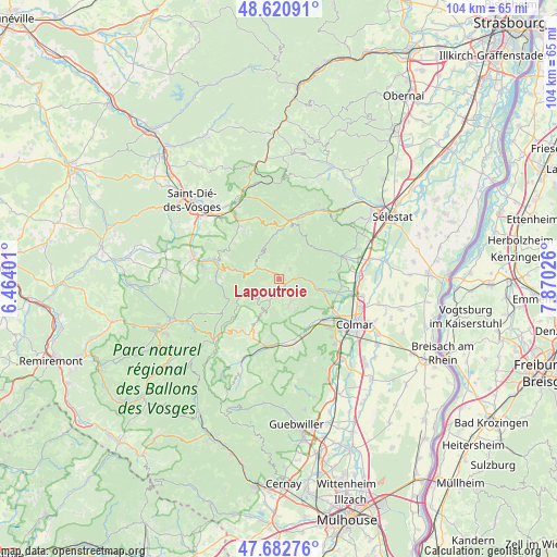
Lapoutroie GPS coordinates[2]
48° 9' 14.328" North, 7° 10' 1.704" East
| Map corner | latitude | longitude |
|---|---|---|
| Upper-left | 48.62091°, | 6.46401° |
| Center: | 48.15398°, | 7.16714° |
| Lower-right: | 47.68276°, | 7.87026° |
| Map W x H: | 104.3×104.3 km | = 64.8×64.8mi |
| max Lat: | 51.07786° ⇑37.9% North |
| Lapoutroie: | 48.15398° |
| min Lat: | ⇓62.1% South 41.3874° |
| min Long | Lapoutroie | max Long |
| -5.08615° | 7.16714° | 9.52242° |
| W 95.6%⇐ | ⇒4.4% E |
Elevation
Elevation of Lapoutroie is 430 m = 1411 ft, and this is 236.3 m = 775 ft above average elevation for this country.
| Max E: |
2333 m = 7654 ft | 9.8% |
| Lapoutroie | 430 m 1411 ft | |
| Avg. | 193.7 m = 635 ft | |
Min E: |
-1 m = -3 ft | 90.2% |
See also: France elevation on elevation.city.
Geographical zone
Lapoutroie is located in North temperate zone (between Tropic of Cancer and the Arctic Circle). Distance of this North polar circle is 2047 km =1271.9 mi to North.| Distance of | km | miles | from Lapoutroie |
|---|---|---|---|
| North Pole | 4652.8 | 2891.1 | to North |
| Arctic Circle | 2047 | 1271.9 | to North |
| Tropic Cancer | 2748.3 | 1707.7 | to South |
| Equator | 5354.2 | 3326.9 | to South |


Nearby cities:
15 places around Lapoutroie: (largest is in red/bold)
• Ammerschwihr
9.1 km =5.7 mi,  110°
110°
• Fréland
2.7 km =1.7 mi,  42°
42°
• Katzenthal
9.9 km =6.2 mi,  120°
120°
• Kaysersberg
7.4 km =4.6 mi,  103°
103°
• Kientzheim
9 km =5.6 mi, 102°
• Labaroche
5.2 km =3.2 mi,  158°
158°
• Le Bonhomme
4.3 km =2.7 mi,  297°
297°
• Niedermorschwihr
9.9 km =6.2 mi,  127°
127°
• Orbey
3.1 km =1.9 mi,  183°
183°
• Riquewihr
9.7 km =6 mi,  81°
81°
• Sainte-Marie-aux-Mines
10.4 km =6.5 mi,  6°
6°
• Sigolsheim
10.1 km =6.3 mi, 102°
• Turckheim
11 km =6.8 mi, 132°
• Walbach
10.9 km =6.8 mi, 157°
• Zimmerbach
10.3 km =6.4 mi,  150°
150°
Sources, notices
• [Note1] Compared only with cities in France existing in our database
• [Src1] Map data: © OpenStreetMap contributors (CC-BY-SA)
• [Src2] Other city data from geonames.org with taken over terms of usage.
• [Src3] Geographical zone / Annual Mean Temperature by Robert A. Rohde @ Wikipedia
