Freistroff geodata
Freistroff (Grand Est) is a populated place; located in France in Europe/Paris (GMT+2) time zone. With population of 885 people, there are 9782 cities with bigger population in this country. Compared to other cities in France, 85.7% of cities are located further ↓South; 91.7% of cities are located further ←West and 66.2% of cities have lower elevation than Freistroff. Note1
Administrative division(s):
- Level 1: Grand Est
- Level 2: Moselle
- Level 3: Arrondissement de Forbach-Boulay-Moselle
- Level 4: Freistroff


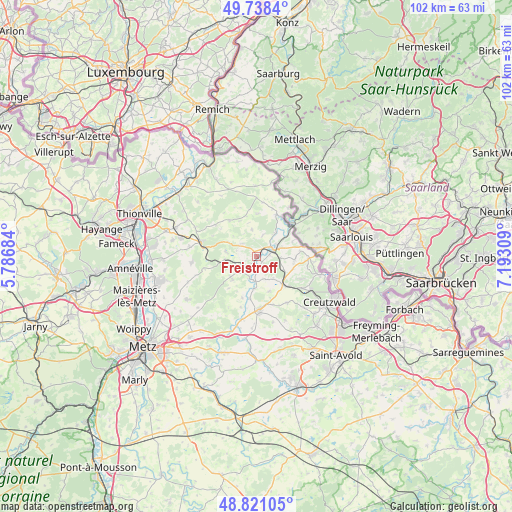
Freistroff GPS coordinates[2]
49° 16' 54.696" North, 6° 29' 23.856" East
| Map corner | latitude | longitude |
|---|---|---|
| Upper-left | 49.7384°, | 5.78684° |
| Center: | 49.28186°, | 6.48996° |
| Lower-right: | 48.82105°, | 7.19309° |
| Map W x H: | 102×102 km | = 63.4×63.4mi |
| max Lat: | 51.07786° ⇑14.3% North |
| Freistroff: | 49.28186° |
| min Lat: | ⇓85.7% South 41.3874° |
| min Long | Freistroff | max Long |
| -5.08615° | 6.48996° | 9.52242° |
| W 91.7%⇐ | ⇒8.3% E |
Elevation
Elevation of Freistroff is 200 m = 656 ft, and this is 6.3 m = 21 ft above average elevation for this country.
| Max E: |
2333 m = 7654 ft | 33.8% |
| Freistroff | 200 m 656 ft | |
| Avg. | 193.7 m = 635 ft | |
Min E: |
-1 m = -3 ft | 66.2% |
See also: France elevation on elevation.city.
Geographical zone
Freistroff is located in North temperate zone (between Tropic of Cancer and the Arctic Circle). Distance of this North polar circle is 1921.5 km =1194 mi to North.| Distance of | km | miles | from Freistroff |
|---|---|---|---|
| North Pole | 4527.4 | 2813.2 | to North |
| Arctic Circle | 1921.5 | 1194 | to North |
| Tropic Cancer | 2873.7 | 1785.6 | to South |
| Equator | 5479.6 | 3404.9 | to South |


Nearby cities:
15 places around Freistroff: (largest is in red/bold)
• Boulay-Moselle
11 km =6.8 mi,  176°
176°
• Bouzonville
3.4 km =2.1 mi,  70°
70°
• Coume
11.1 km =6.9 mi,  146°
146°
• Dalem
9.9 km =6.2 mi,  117°
117°
• Falck
12.1 km =7.5 mi, 120°
• Filstroff
5.8 km =3.6 mi,  38°
38°
• Hargarten-aux-Mines
11.1 km =6.9 mi,  125°
125°
• Heining-lès-Bouzonville
7.9 km =4.9 mi, 66°
• Hombourg
10.8 km =6.7 mi,  278°
278°
• Kédange-sur-Canner
11.4 km =7.1 mi,  285°
285°
• Piblange
6.3 km =3.9 mi,  237°
237°
• Téterchen
7.7 km =4.8 mi,  137°
137°
• Vaudreching
2.6 km =1.6 mi,  84°
84°
• Veckring
10.3 km =6.4 mi,  307°
307°
• Ébersviller
6.5 km =4 mi,  263°
263°
Sources, notices
• [Note1] Compared only with cities in France existing in our database
• [Src1] Map data: © OpenStreetMap contributors (CC-BY-SA)
• [Src2] Other city data from geonames.org with taken over terms of usage.
• [Src3] Geographical zone / Annual Mean Temperature by Robert A. Rohde @ Wikipedia
