Fontcouverte-la Toussuire geodata
Fontcouverte-la Toussuire (Auvergne-Rhône-Alpes) is a populated place; located in France in Europe/Paris (GMT+2) time zone. With population of 538 people, there are 14429 cities with bigger population in this country. Compared to other cities in France, 76.9% of cities are located further ↑North; 90.2% of cities are located further ←West and 99.7% of cities have lower elevation than Fontcouverte-la Toussuire. Note1
Administrative division(s):
- Level 1: Auvergne-Rhône-Alpes
- Level 2: Savoie
- Level 3: Arrondissement de Saint-Jean-de-Maurienne
- Level 4: Fontcouverte-la-Toussuire
Current local time in Fontcouverte-la Toussuire:
01:45 PM, MondayDifference from your time zone: hours


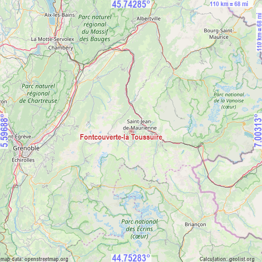
Fontcouverte-la Toussuire GPS coordinates[2]
45° 15' 0" North, 6° 18' 0" East
| Map corner | latitude | longitude |
|---|---|---|
| Upper-left | 45.74285°, | 5.59688° |
| Center: | 45.25°, | 6.3° |
| Lower-right: | 44.75283°, | 7.00313° |
| Map W x H: | 110.1×110.1 km | = 68.4×68.4mi |
| max Lat: | 51.07786° ⇑76.9% North |
| Fontcouverte-la Toussuire: | 45.25° |
| min Lat: | ⇓23.1% South 41.3874° |
| min Long | Fontcouverte-la | max Long |
| -5.08615° | 6.3° | 9.52242° |
| W 90.2%⇐ | ⇒9.8% E |
Elevation
Elevation of Fontcouverte-la Toussuire is 1217 m = 3993 ft, and this is 1023.3 m = 3357 ft above average elevation for this country.
| Max E: |
2333 m = 7654 ft | 0.3% |
| Fontcouverte-la Toussuire | 1217 m 3993 ft | |
| Avg. | 193.7 m = 635 ft | |
Min E: |
-1 m = -3 ft | 99.7% |
See also: France elevation on elevation.city.
Geographical zone
Fontcouverte-la Toussuire is located in North temperate zone (between Tropic of Cancer and the Arctic Circle). Distance of this North polar circle is 2369.8 km =1472.5 mi to North.| Distance of | km | miles | from Fontcouverte-la Toussuire |
|---|---|---|---|
| North Pole | 4975.7 | 3091.8 | to North |
| Arctic Circle | 2369.8 | 1472.5 | to North |
| Tropic Cancer | 2425.4 | 1507.1 | to South |
| Equator | 5031.3 | 3126.3 | to South |


Nearby cities:
15 places around Fontcouverte-la Toussuire: (largest is in red/bold)
• Albanne
10.6 km =6.6 mi,  117°
117°
• Hermillon
7.2 km =4.5 mi,  42°
42°
• La Chambre
12.1 km =7.5 mi,  359°
359°
• Saint-Avre
11.7 km =7.3 mi,  2°
2°
• Saint-Etienne-de-Cuines
11.2 km =7 mi,  353°
353°
• Saint-Jean-de-Maurienne
5 km =3.1 mi,  55°
55°
• Saint-Martin-de-Belleville
21.7 km =13.5 mi,  47°
47°
• Saint-Martin-de-la-Porte
11.5 km =7.1 mi,  96°
96°
• Saint-Michel-de-Maurienne
13.6 km =8.5 mi, 104°
• Saint-Rémy-de-Maurienne
16.9 km =10.5 mi, 351°
• Sainte-Marie-de-Cuines
9.8 km =6.1 mi, 1°
• Valloire
13.9 km =8.6 mi,  132°
132°
• Valmeinier
15.9 km =9.9 mi, 116°
• Villargondran
6.2 km =3.9 mi,  75°
75°
• Épierre
22.5 km =14 mi, 359°
Sources, notices
• [Note1] Compared only with cities in France existing in our database
• [Src1] Map data: © OpenStreetMap contributors (CC-BY-SA)
• [Src2] Other city data from geonames.org with taken over terms of usage.
• [Src3] Geographical zone / Annual Mean Temperature by Robert A. Rohde @ Wikipedia
