Hermillon geodata
Hermillon (Auvergne-Rhône-Alpes) is a populated place; located in France in Europe/Paris (GMT+2) time zone. With population of 566 people, there are 13895 cities with bigger population in this country. Compared to other cities in France, 76.4% of cities are located further ↑North; 90.8% of cities are located further ←West and 97.6% of cities have lower elevation than Hermillon. Note1
Administrative division(s):
- Level 1: Auvergne-Rhône-Alpes
- Level 2: Savoie
- Level 3: Arrondissement de Saint-Jean-de-Maurienne
- Level 4: La Tour-en-Maurienne


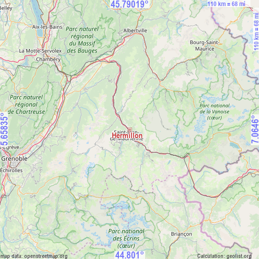
Hermillon GPS coordinates[2]
45° 17' 51.9" North, 6° 21' 41.292" East
| Map corner | latitude | longitude |
|---|---|---|
| Upper-left | 45.79019°, | 5.65835° |
| Center: | 45.29775°, | 6.36147° |
| Lower-right: | 44.801°, | 7.0646° |
| Map W x H: | 110×110 km | = 68.4×68.4mi |
| max Lat: | 51.07786° ⇑76.4% North |
| Hermillon: | 45.29775° |
| min Lat: | ⇓23.6% South 41.3874° |
| min Long | Hermillon | max Long |
| -5.08615° | 6.36147° | 9.52242° |
| W 90.8%⇐ | ⇒9.2% E |
Elevation
Elevation of Hermillon is 777 m = 2549 ft, and this is 583.3 m = 1914 ft above average elevation for this country.
| Max E: |
2333 m = 7654 ft | 2.4% |
| Hermillon | 777 m 2549 ft | |
| Avg. | 193.7 m = 635 ft | |
Min E: |
-1 m = -3 ft | 97.6% |
See also: France elevation on elevation.city.
Geographical zone
Hermillon is located in North temperate zone (between Tropic of Cancer and the Arctic Circle). Distance of this North polar circle is 2364.5 km =1469.2 mi to North.| Distance of | km | miles | from Hermillon |
|---|---|---|---|
| North Pole | 4970.4 | 3088.5 | to North |
| Arctic Circle | 2364.5 | 1469.2 | to North |
| Tropic Cancer | 2430.7 | 1510.4 | to South |
| Equator | 5036.6 | 3129.6 | to South |


Nearby cities:
15 places around Hermillon: (largest is in red/bold)
• Albanne
11.2 km =7 mi,  155°
155°
• Fontcouverte-la Toussuire
7.2 km =4.5 mi,  222°
222°
• La Chambre
8.3 km =5.2 mi,  324°
324°
• Saint-Avre
7.7 km =4.8 mi,  325°
325°
• Saint-Etienne-de-Cuines
8.4 km =5.2 mi,  313°
313°
• Saint-Jean-de-Maurienne
2.6 km =1.6 mi,  195°
195°
• Saint-Martin-de-Belleville
14.6 km =9.1 mi,  50°
50°
• Saint-Martin-de-la-Porte
9.4 km =5.8 mi,  134°
134°
• Saint-Michel-de-Maurienne
12 km =7.5 mi,  135°
135°
• Saint-Rémy-de-Maurienne
13.6 km =8.5 mi, 326°
• Sainte-Marie-de-Cuines
6.3 km =3.9 mi, 315°
• Val Thorens
17.4 km =10.8 mi,  89°
89°
• Valloire
15.7 km =9.8 mi, 159°
• Valmeinier
15.6 km =9.7 mi, 143°
• Villargondran
3.9 km =2.4 mi, 162°
Sources, notices
• [Note1] Compared only with cities in France existing in our database
• [Src1] Map data: © OpenStreetMap contributors (CC-BY-SA)
• [Src2] Other city data from geonames.org with taken over terms of usage.
• [Src3] Geographical zone / Annual Mean Temperature by Robert A. Rohde @ Wikipedia
