Fleury geodata
Fleury (Normandy) is a populated place; located in France in Europe/Paris (GMT+2) time zone. With population of 782 people, there are 10798 cities with bigger population in this country. Compared to other cities in France, 76.5% of cities are located further ↓South; 90.6% of cities are located further →East and 61.5% of cities have lower elevation than Fleury. Note1
Administrative division(s):
- Level 1: Normandy
- Level 2: Manche
- Level 3: Arrondissement de Saint-Lô
- Level 4: Fleury


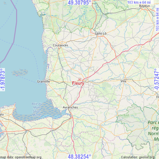
Fleury GPS coordinates[2]
48° 50' 50.568" North, 1° 16' 32.16" West
| Map corner | latitude | longitude |
|---|---|---|
| Upper-left | 49.30795°, | -1.97873° |
| Center: | 48.84738°, | -1.2756° |
| Lower-right: | 48.38254°, | -0.57247° |
| Map W x H: | 102.9×102.9 km | = 63.9×63.9mi |
| max Lat: | 51.07786° ⇑23.5% North |
| Fleury: | 48.84738° |
| min Lat: | ⇓76.5% South 41.3874° |
| min Long | Fleury | max Long |
| -5.08615° | -1.2756° | 9.52242° |
| W 9.4%⇐ | ⇒90.6% E |
Elevation
Elevation of Fleury is 177 m = 581 ft, and this is 16.7 m = 55 ft below average elevation for this country.
| Max E: |
2333 m = 7654 ft | 38.5% |
| Avg. | 193.7 m = 635 ft | |
| Fleury | 177 m = 581 ft | |
Min E: |
-1 m = -3 ft | 61.5% |
See also: France elevation on elevation.city.
Geographical zone
Fleury is located in North temperate zone (between Tropic of Cancer and the Arctic Circle). Distance of this North polar circle is 1969.9 km =1224 mi to North.| Distance of | km | miles | from Fleury |
|---|---|---|---|
| North Pole | 4575.7 | 2843.2 | to North |
| Arctic Circle | 1969.9 | 1224 | to North |
| Tropic Cancer | 2825.4 | 1755.6 | to South |
| Equator | 5431.3 | 3374.9 | to South |


Nearby cities:
15 places around Fleury: (largest is in red/bold)
• Beslon
9.1 km =5.7 mi,  88°
88°
• Coulouvray-Boisbenâtre
13.9 km =8.6 mi,  119°
119°
• Courson
14.4 km =8.9 mi, 86°
• Cérences
14 km =8.7 mi,  303°
303°
• Folligny
10.2 km =6.3 mi,  255°
255°
• Gavray
9 km =5.6 mi,  322°
322°
• Hambye
11.2 km =7 mi,  4°
4°
• La Colombe
7.6 km =4.7 mi,  65°
65°
• La Haye-Pesnel
10.6 km =6.6 mi,  236°
236°
• Lolif
15.3 km =9.5 mi,  214°
214°
• Percy
10 km =6.2 mi,  39°
39°
• Saint-Jean-des-Champs
14 km =8.7 mi, 261°
• Sainte-Cécile
6.4 km =4 mi,  102°
102°
• Tirepied
15.3 km =9.5 mi,  176°
176°
• Villedieu-les-Poêles
4.6 km =2.9 mi,  109°
109°
Sources, notices
• [Note1] Compared only with cities in France existing in our database
• [Src1] Map data: © OpenStreetMap contributors (CC-BY-SA)
• [Src2] Other city data from geonames.org with taken over terms of usage.
• [Src3] Geographical zone / Annual Mean Temperature by Robert A. Rohde @ Wikipedia
