Flaxlanden geodata
Flaxlanden (Grand Est) is a populated place; located in France in Europe/Paris (GMT+2) time zone. With population of 1,312 people, there are 6966 cities with bigger population in this country. Compared to other cities in France, 54.1% of cities are located further ↓South; 96.7% of cities are located further ←West and 79.9% of cities have lower elevation than Flaxlanden. Note1
Administrative division(s):
- Level 1: Grand Est
- Level 2: Haut-Rhin
- Level 3: Arrondissement de Mulhouse
- Level 4: Flaxlanden


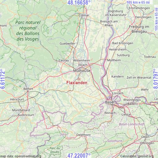
Flaxlanden GPS coordinates[2]
47° 41' 43.692" North, 7° 18' 53.424" East
| Map corner | latitude | longitude |
|---|---|---|
| Upper-left | 48.16658°, | 6.61172° |
| Center: | 47.69547°, | 7.31484° |
| Lower-right: | 47.22007°, | 8.01797° |
| Map W x H: | 105.2×105.2 km | = 65.4×65.4mi |
| max Lat: | 51.07786° ⇑45.9% North |
| Flaxlanden: | 47.69547° |
| min Lat: | ⇓54.1% South 41.3874° |
| min Long | Flaxlanden | max Long |
| -5.08615° | 7.31484° | 9.52242° |
| W 96.7%⇐ | ⇒3.3% E |
Elevation
Elevation of Flaxlanden is 289 m = 948 ft, and this is 95.3 m = 313 ft above average elevation for this country.
| Max E: |
2333 m = 7654 ft | 20.1% |
| Flaxlanden | 289 m 948 ft | |
| Avg. | 193.7 m = 635 ft | |
Min E: |
-1 m = -3 ft | 79.9% |
See also: France elevation on elevation.city.
Geographical zone
Flaxlanden is located in North temperate zone (between Tropic of Cancer and the Arctic Circle). Distance of this North polar circle is 2097.9 km =1303.6 mi to North.| Distance of | km | miles | from Flaxlanden |
|---|---|---|---|
| North Pole | 4703.8 | 2922.8 | to North |
| Arctic Circle | 2097.9 | 1303.6 | to North |
| Tropic Cancer | 2697.3 | 1676 | to South |
| Equator | 5303.2 | 3295.3 | to South |


Nearby cities:
15 places around Flaxlanden: (largest is in red/bold)
• Bruebach
3.4 km =2.1 mi,  80°
80°
• Brunstatt
2.9 km =1.8 mi,  7°
7°
• Didenheim
2.8 km =1.7 mi,  338°
338°
• Frœningen
3.8 km =2.4 mi,  249°
249°
• Hochstatt
3 km =1.9 mi,  288°
288°
• Illfurth
4.4 km =2.7 mi,  236°
236°
• Landser
5.7 km =3.5 mi,  101°
101°
• Luemschwiller
5 km =3.1 mi,  204°
204°
• Morschwiller-le-Bas
5.7 km =3.5 mi,  323°
323°
• Mulhouse
6.4 km =4 mi, 9°
• Steinbrunn-le-Bas
4.5 km =2.8 mi,  119°
119°
• Steinbrunn-le-Haut
4.6 km =2.9 mi,  147°
147°
• Tagolsheim
5.4 km =3.4 mi,  217°
217°
• Zillisheim
1.3 km =0.8 mi,  272°
272°
• Zimmersheim
6.2 km =3.9 mi,  62°
62°
Sources, notices
• [Note1] Compared only with cities in France existing in our database
• [Src1] Map data: © OpenStreetMap contributors (CC-BY-SA)
• [Src2] Other city data from geonames.org with taken over terms of usage.
• [Src3] Geographical zone / Annual Mean Temperature by Robert A. Rohde @ Wikipedia
