Steinbrunn-le-Bas geodata
Steinbrunn-le-Bas (Grand Est) is a populated place; located in France in Europe/Paris (GMT+2) time zone. With population of 674 people, there are 12156 cities with bigger population in this country. Compared to other cities in France, 53.9% of cities are located further ↓South; 97.1% of cities are located further ←West and 78% of cities have lower elevation than Steinbrunn-le-Bas. Note1
Administrative division(s):
- Level 1: Grand Est
- Level 2: Haut-Rhin
- Level 3: Arrondissement de Mulhouse
- Level 4: Steinbrunn-le-Bas


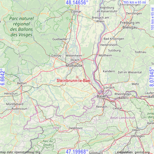
Steinbrunn-le-Bas GPS coordinates[2]
47° 40' 30.972" North, 7° 22' 2.352" East
| Map corner | latitude | longitude |
|---|---|---|
| Upper-left | 48.14656°, | 6.6642° |
| Center: | 47.67527°, | 7.36732° |
| Lower-right: | 47.19968°, | 8.07045° |
| Map W x H: | 105.3×105.3 km | = 65.4×65.4mi |
| max Lat: | 51.07786° ⇑46.1% North |
| Steinbrunn-le-Bas: | 47.67527° |
| min Lat: | ⇓53.9% South 41.3874° |
| min Long | Steinbrunn-le-B | max Long |
| -5.08615° | 7.36732° | 9.52242° |
| W 97.1%⇐ | ⇒2.9% E |
Elevation
Elevation of Steinbrunn-le-Bas is 272 m = 892 ft, and this is 78.3 m = 257 ft above average elevation for this country.
| Max E: |
2333 m = 7654 ft | 22% |
| Steinbrunn-le-Bas | 272 m 892 ft | |
| Avg. | 193.7 m = 635 ft | |
Min E: |
-1 m = -3 ft | 78% |
See also: France elevation on elevation.city.
Geographical zone
Steinbrunn-le-Bas is located in North temperate zone (between Tropic of Cancer and the Arctic Circle). Distance of this North polar circle is 2100.2 km =1305 mi to North.| Distance of | km | miles | from Steinbrunn-le-Bas |
|---|---|---|---|
| North Pole | 4706.1 | 2924.2 | to North |
| Arctic Circle | 2100.2 | 1305 | to North |
| Tropic Cancer | 2695.1 | 1674.7 | to South |
| Equator | 5301 | 3293.9 | to South |


Nearby cities:
15 places around Steinbrunn-le-Bas: (largest is in red/bold)
• Bruebach
2.9 km =1.8 mi,  347°
347°
• Brunstatt
6.2 km =3.9 mi,  325°
325°
• Dietwiller
3.3 km =2.1 mi,  53°
53°
• Eschentzwiller
4.7 km =2.9 mi,  28°
28°
• Flaxlanden
4.5 km =2.8 mi,  299°
299°
• Kœtzingue
3.1 km =1.9 mi,  156°
156°
• Landser
2 km =1.2 mi,  57°
57°
• Luemschwiller
6.4 km =4 mi,  249°
249°
• Rantzwiller
2.6 km =1.6 mi,  167°
167°
• Schlierbach
3.1 km =1.9 mi,  74°
74°
• Steinbrunn-le-Haut
2.2 km =1.4 mi,  220°
220°
• Uffheim
6.3 km =3.9 mi,  116°
116°
• Waltenheim
4.8 km =3 mi,  114°
114°
• Zillisheim
5.7 km =3.5 mi,  293°
293°
• Zimmersheim
5.3 km =3.3 mi,  17°
17°
Sources, notices
• [Note1] Compared only with cities in France existing in our database
• [Src1] Map data: © OpenStreetMap contributors (CC-BY-SA)
• [Src2] Other city data from geonames.org with taken over terms of usage.
• [Src3] Geographical zone / Annual Mean Temperature by Robert A. Rohde @ Wikipedia
