Eyzin-Pinet geodata
Eyzin-Pinet (Auvergne-Rhône-Alpes) is a populated place; located in France in Europe/Paris (GMT+2) time zone. With population of 2,087 people, there are 4615 cities with bigger population in this country. Compared to other cities in France, 74.4% of cities are located further ↑North; 77.6% of cities are located further ←West and 80% of cities have lower elevation than Eyzin-Pinet. Note1
Administrative division(s):
- Level 1: Auvergne-Rhône-Alpes
- Level 2: Département de l'Isère
- Level 3: Arrondissement de Vienne
- Level 4: Eyzin-Pinet


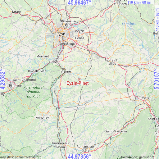
Eyzin-Pinet GPS coordinates[2]
45° 28' 25.572" North, 4° 59' 54.42" East
| Map corner | latitude | longitude |
|---|---|---|
| Upper-left | 45.96467°, | 4.29532° |
| Center: | 45.47377°, | 4.99845° |
| Lower-right: | 44.97856°, | 5.70157° |
| Map W x H: | 109.6×109.6 km | = 68.1×68.1mi |
| max Lat: | 51.07786° ⇑74.4% North |
| Eyzin-Pinet: | 45.47377° |
| min Lat: | ⇓25.6% South 41.3874° |
| min Long | Eyzin-Pinet | max Long |
| -5.08615° | 4.99845° | 9.52242° |
| W 77.6%⇐ | ⇒22.4% E |
Elevation
Elevation of Eyzin-Pinet is 290 m = 951 ft, and this is 96.3 m = 316 ft above average elevation for this country.
| Max E: |
2333 m = 7654 ft | 20% |
| Eyzin-Pinet | 290 m 951 ft | |
| Avg. | 193.7 m = 635 ft | |
Min E: |
-1 m = -3 ft | 80% |
See also: France elevation on elevation.city.
Geographical zone
Eyzin-Pinet is located in North temperate zone (between Tropic of Cancer and the Arctic Circle). Distance of this North polar circle is 2345 km =1457.1 mi to North.| Distance of | km | miles | from Eyzin-Pinet |
|---|---|---|---|
| North Pole | 4950.9 | 3076.3 | to North |
| Arctic Circle | 2345 | 1457.1 | to North |
| Tropic Cancer | 2450.3 | 1522.5 | to South |
| Equator | 5056.2 | 3141.8 | to South |


Nearby cities:
15 places around Eyzin-Pinet: (largest is in red/bold)
• Beauvoir-de-Marc
8.1 km =5 mi,  50°
50°
• Cour-et-Buis
3.7 km =2.3 mi,  171°
171°
• Estrablin
5.4 km =3.4 mi,  328°
328°
• Jardin
7.5 km =4.7 mi,  289°
289°
• Meyssiez
4.6 km =2.9 mi,  97°
97°
• Moidieu
4.8 km =3 mi,  8°
8°
• Monsteroux-Milieu
6.4 km =4 mi,  219°
219°
• Montseveroux
5.4 km =3.4 mi,  204°
204°
• Oytier-Saint-Oblas
9.7 km =6 mi,  15°
15°
• Pont-Évêque
9.5 km =5.9 mi,  313°
313°
• Primarette
8.4 km =5.2 mi,  163°
163°
• Saint-Sorlin-de-Vienne
5.1 km =3.2 mi,  261°
261°
• Savas
5.9 km =3.7 mi, 53°
• Septème
8.8 km =5.5 mi,  3°
3°
• Villeneuve-de-Marc
8 km =5 mi,  87°
87°
Sources, notices
• [Note1] Compared only with cities in France existing in our database
• [Src1] Map data: © OpenStreetMap contributors (CC-BY-SA)
• [Src2] Other city data from geonames.org with taken over terms of usage.
• [Src3] Geographical zone / Annual Mean Temperature by Robert A. Rohde @ Wikipedia
