Étel geodata
Étel (Brittany) is a populated place; located in France in Europe/Paris (GMT+2) time zone. With population of 2,068 people, there are 4642 cities with bigger population in this country. Compared to other cities in France, 53.6% of cities are located further ↓South; 97.8% of cities are located further →East and 99% of cities have higher elevation than Étel. Note1
Administrative division(s):
- Level 1: Brittany
- Level 2: Morbihan
- Level 3: Arrondissement de Lorient
- Level 4: Étel


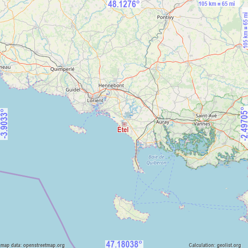
Étel GPS coordinates[2]
47° 39' 22.104" North, 3° 12' 0.648" West
| Map corner | latitude | longitude |
|---|---|---|
| Upper-left | 48.1276°, | -3.9033° |
| Center: | 47.65614°, | -3.20018° |
| Lower-right: | 47.18038°, | -2.49705° |
| Map W x H: | 105.3×105.3 km | = 65.4×65.4mi |
| max Lat: | 51.07786° ⇑46.4% North |
| Étel: | 47.65614° |
| min Lat: | ⇓53.6% South 41.3874° |
| min Long | Étel | max Long |
| -5.08615° | -3.20018° | 9.52242° |
| W 2.2%⇐ | ⇒97.8% E |
Elevation
Elevation of Étel is 6 m = 20 ft, and this is 187.7 m = 616 ft below average elevation for this country.
| Max E: |
2333 m = 7654 ft | 99% |
| Avg. | 193.7 m = 635 ft | |
| Étel | 6 m = 20 ft | |
Min E: |
-1 m = -3 ft | 1% |
See also: France elevation on elevation.city.
Geographical zone
Étel is located in North temperate zone (between Tropic of Cancer and the Arctic Circle). Distance of this North polar circle is 2102.3 km =1306.3 mi to North.| Distance of | km | miles | from Étel |
|---|---|---|---|
| North Pole | 4708.2 | 2925.5 | to North |
| Arctic Circle | 2102.3 | 1306.3 | to North |
| Tropic Cancer | 2692.9 | 1673.3 | to South |
| Equator | 5298.9 | 3292.6 | to South |


Nearby cities:
15 places around Étel: (largest is in red/bold)
• Belz
3.2 km =2 mi,  48°
48°
• Carnac
12.2 km =7.6 mi,  131°
131°
• Erdeven
3.6 km =2.2 mi,  115°
115°
• Gâvres
12.2 km =7.6 mi,  290°
290°
• Kervignac
12.2 km =7.6 mi,  346°
346°
• Landévant
13.4 km =8.3 mi,  25°
25°
• Locmiquélic
13.1 km =8.1 mi,  305°
305°
• Locoal-Mendon
8.8 km =5.5 mi, 51°
• Merlevenez
9.1 km =5.7 mi, 345°
• Nostang
10.3 km =6.4 mi,  5°
5°
• Ploemel
9.7 km =6 mi,  93°
93°
• Plouharnel
9.2 km =5.7 mi, 134°
• Port-Louis
12.9 km =8 mi,  296°
296°
• Riantec
10.6 km =6.6 mi, 305°
• Sainte-Hélène
7.1 km =4.4 mi,  357°
357°
Sources, notices
• [Note1] Compared only with cities in France existing in our database
• [Src1] Map data: © OpenStreetMap contributors (CC-BY-SA)
• [Src2] Other city data from geonames.org with taken over terms of usage.
• [Src3] Geographical zone / Annual Mean Temperature by Robert A. Rohde @ Wikipedia
