Er geodata
Er (Occitanie) is a populated place; located in France in Europe/Paris (GMT+2) time zone. With population of 606 people, there are 13224 cities with bigger population in this country. Compared to other cities in France, 99.6% of cities are located further ↑North; 56.7% of cities are located further →East and 99.8% of cities have lower elevation than Er. Note1
Administrative division(s):
- Level 1: Occitanie
- Level 2: Département des Pyrénées-Orientales
- Level 3: Arrondissement de Prades
- Level 4: Err


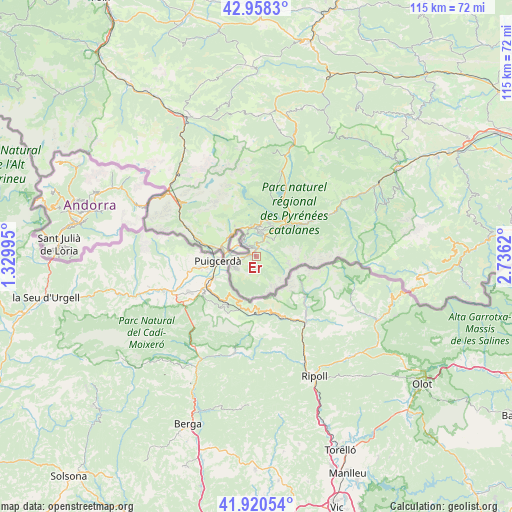
Er GPS coordinates[2]
42° 26' 29.652" North, 2° 1' 59.052" East
| Map corner | latitude | longitude |
|---|---|---|
| Upper-left | 42.9583°, | 1.32995° |
| Center: | 42.44157°, | 2.03307° |
| Lower-right: | 41.92054°, | 2.7362° |
| Map W x H: | 115.4×115.4 km | = 71.7×71.7mi |
| max Lat: | 51.07786° ⇑99.6% North |
| Er: | 42.44157° |
| min Lat: | ⇓0.4% South 41.3874° |
| min Long | Er | max Long |
| -5.08615° | 2.03307° | 9.52242° |
| W 43.3%⇐ | ⇒56.7% E |
Elevation
Elevation of Er is 1369 m = 4491 ft, and this is 1175.3 m = 3856 ft above average elevation for this country.
| Max E: |
2333 m = 7654 ft | 0.2% |
| Er | 1369 m 4491 ft | |
| Avg. | 193.7 m = 635 ft | |
Min E: |
-1 m = -3 ft | 99.8% |
See also: France elevation on elevation.city.
Geographical zone
Er is located in North temperate zone (between Tropic of Cancer and the Arctic Circle). Distance of this Northern Tropic circle is 2113.1 km =1313 mi to South.| Distance of | km | miles | from Er |
|---|---|---|---|
| North Pole | 5288 | 3285.8 | to North |
| Arctic Circle | 2682.1 | 1666.6 | to North |
| Tropic Cancer | 2113.1 | 1313 | to South |
| Equator | 4719.1 | 2932.3 | to South |


Nearby cities:
15 places around Er: (largest is in red/bold)
• Angostrina
7.6 km =4.7 mi,  307°
307°
• Ax-les-Thermes
34.8 km =21.6 mi,  332°
332°
• Bolquère
7.7 km =4.8 mi,  28°
28°
• Enveig
10.1 km =6.3 mi,  282°
282°
• Font-Romeu-Odeillo-Via
7.1 km =4.4 mi,  4°
4°
• La Cabanasse
9.3 km =5.8 mi,  45°
45°
• Les Angles
15.6 km =9.7 mi,  12°
12°
• Osséja
5.2 km =3.2 mi,  233°
233°
• Palau-de-Cerdagne
6.1 km =3.8 mi,  241°
241°
• Prades
37.4 km =23.2 mi,  58°
58°
• Prats de Molló
36.9 km =22.9 mi,  96°
96°
• Ria-Sirach
35.8 km =22.2 mi, 57°
• Saillagouse
2 km =1.2 mi, 13°
• Vernet-les-Bains
31.4 km =19.5 mi,  67°
67°
• la Guingueta d'Ix
7.4 km =4.6 mi,  263°
263°
Sources, notices
• [Note1] Compared only with cities in France existing in our database
• [Src1] Map data: © OpenStreetMap contributors (CC-BY-SA)
• [Src2] Other city data from geonames.org with taken over terms of usage.
• [Src3] Geographical zone / Annual Mean Temperature by Robert A. Rohde @ Wikipedia
