Ernolsheim-Bruche geodata
Ernolsheim-Bruche (Grand Est) is a populated place; located in France in Europe/Paris (GMT+2) time zone. With population of 1,786 people, there are 5315 cities with bigger population in this country. Compared to other cities in France, 69.9% of cities are located further ↓South; 98.4% of cities are located further ←West and 60% of cities have lower elevation than Ernolsheim-Bruche. Note1
Administrative division(s):
- Level 1: Grand Est
- Level 2: Bas-Rhin
- Level 3: Arrondissement de Molsheim
- Level 4: Ernolsheim-Bruche


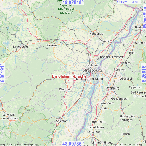
Ernolsheim-Bruche GPS coordinates[2]
48° 33' 55.116" North, 7° 33' 54.108" East
| Map corner | latitude | longitude |
|---|---|---|
| Upper-left | 49.02848°, | 6.86191° |
| Center: | 48.56531°, | 7.56503° |
| Lower-right: | 48.09786°, | 8.26816° |
| Map W x H: | 103.5×103.5 km | = 64.3×64.3mi |
| max Lat: | 51.07786° ⇑30.1% North |
| Ernolsheim-Bruche: | 48.56531° |
| min Lat: | ⇓69.9% South 41.3874° |
| min Long | Ernolsheim-Bruc | max Long |
| -5.08615° | 7.56503° | 9.52242° |
| W 98.4%⇐ | ⇒1.6% E |
Elevation
Elevation of Ernolsheim-Bruche is 170 m = 558 ft, and this is 23.7 m = 78 ft below average elevation for this country.
| Max E: |
2333 m = 7654 ft | 40% |
| Avg. | 193.7 m = 635 ft | |
| Ernolsheim-Bruche | 170 m = 558 ft | |
Min E: |
-1 m = -3 ft | 60% |
See also: France elevation on elevation.city.
Geographical zone
Ernolsheim-Bruche is located in North temperate zone (between Tropic of Cancer and the Arctic Circle). Distance of this North polar circle is 2001.2 km =1243.5 mi to North.| Distance of | km | miles | from Ernolsheim-Bruche |
|---|---|---|---|
| North Pole | 4607.1 | 2862.7 | to North |
| Arctic Circle | 2001.2 | 1243.5 | to North |
| Tropic Cancer | 2794 | 1736.1 | to South |
| Equator | 5400 | 3355.4 | to South |


Nearby cities:
15 places around Ernolsheim-Bruche: (largest is in red/bold)
• Achenheim
4.9 km =3 mi,  69°
69°
• Altorf
5.6 km =3.5 mi,  209°
209°
• Avolsheim
4.8 km =3 mi,  265°
265°
• Breuschwickersheim
3.2 km =2 mi,  58°
58°
• Dachstein
2.4 km =1.5 mi,  259°
259°
• Dahlenheim
4.8 km =3 mi,  298°
298°
• Duppigheim
4.6 km =2.9 mi,  152°
152°
• Duttlenheim
4.4 km =2.7 mi,  179°
179°
• Ergersheim
2.8 km =1.7 mi,  280°
280°
• Furdenheim
5.1 km =3.2 mi,  356°
356°
• Hangenbieten
3.7 km =2.3 mi,  99°
99°
• Ittenheim
4.9 km =3 mi,  25°
25°
• Kolbsheim
1.9 km =1.2 mi, 104°
• Osthoffen
2.5 km =1.6 mi,  344°
344°
• Wolxheim
3.9 km =2.4 mi, 275°
Sources, notices
• [Note1] Compared only with cities in France existing in our database
• [Src1] Map data: © OpenStreetMap contributors (CC-BY-SA)
• [Src2] Other city data from geonames.org with taken over terms of usage.
• [Src3] Geographical zone / Annual Mean Temperature by Robert A. Rohde @ Wikipedia
