Duttlenheim geodata
Duttlenheim (Grand Est) is a populated place; located in France in Europe/Paris (GMT+2) time zone. With population of 2,526 people, there are 3864 cities with bigger population in this country. Compared to other cities in France, 69% of cities are located further ↓South; 98.4% of cities are located further ←West and 58.3% of cities have lower elevation than Duttlenheim. Note1
Administrative division(s):
- Level 1: Grand Est
- Level 2: Bas-Rhin
- Level 3: Arrondissement de Molsheim
- Level 4: Duttlenheim


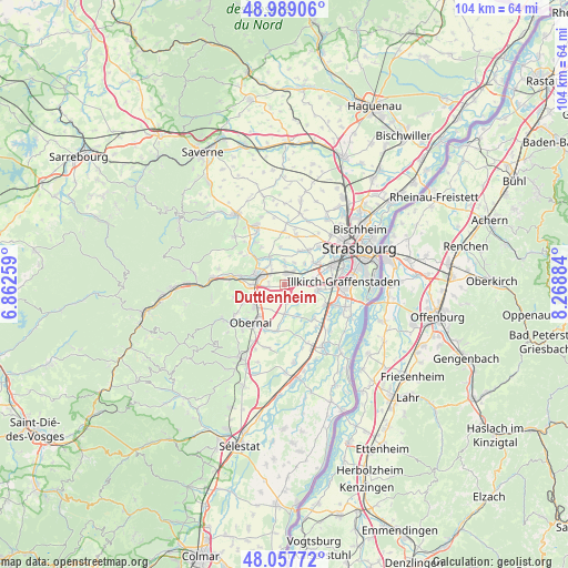
Duttlenheim GPS coordinates[2]
48° 31' 31.908" North, 7° 33' 56.592" East
| Map corner | latitude | longitude |
|---|---|---|
| Upper-left | 48.98906°, | 6.86259° |
| Center: | 48.52553°, | 7.56572° |
| Lower-right: | 48.05772°, | 8.26884° |
| Map W x H: | 103.6×103.6 km | = 64.4×64.4mi |
| max Lat: | 51.07786° ⇑31% North |
| Duttlenheim: | 48.52553° |
| min Lat: | ⇓69% South 41.3874° |
| min Long | Duttlenheim | max Long |
| -5.08615° | 7.56572° | 9.52242° |
| W 98.4%⇐ | ⇒1.6% E |
Elevation
Elevation of Duttlenheim is 162 m = 531 ft, and this is 31.7 m = 104 ft below average elevation for this country.
| Max E: |
2333 m = 7654 ft | 41.7% |
| Avg. | 193.7 m = 635 ft | |
| Duttlenheim | 162 m = 531 ft | |
Min E: |
-1 m = -3 ft | 58.3% |
See also: France elevation on elevation.city.
Geographical zone
Duttlenheim is located in North temperate zone (between Tropic of Cancer and the Arctic Circle). Distance of this North polar circle is 2005.6 km =1246.2 mi to North.| Distance of | km | miles | from Duttlenheim |
|---|---|---|---|
| North Pole | 4611.5 | 2865.5 | to North |
| Arctic Circle | 2005.6 | 1246.2 | to North |
| Tropic Cancer | 2789.6 | 1733.4 | to South |
| Equator | 5395.5 | 3352.6 | to South |


Nearby cities:
15 places around Duttlenheim: (largest is in red/bold)
• Altorf
2.8 km =1.7 mi,  261°
261°
• Blaesheim
3.8 km =2.4 mi,  123°
123°
• Dachstein
4.7 km =2.9 mi,  328°
328°
• Dorlisheim
5.9 km =3.7 mi,  269°
269°
• Duppigheim
2.1 km =1.3 mi,  80°
80°
• Entzheim
5.4 km =3.4 mi, 79°
• Ergersheim
5.7 km =3.5 mi, 330°
• Ernolsheim-Bruche
4.4 km =2.7 mi,  359°
359°
• Geispolsheim
6.2 km =3.9 mi,  99°
99°
• Griesheim-près-Molsheim
3.6 km =2.2 mi,  226°
226°
• Hangenbieten
5.2 km =3.2 mi,  43°
43°
• Innenheim
3.3 km =2.1 mi,  168°
168°
• Kolbsheim
4.3 km =2.7 mi,  24°
24°
• Krautergersheim
5.5 km =3.4 mi,  178°
178°
• Molsheim
5.7 km =3.5 mi,  286°
286°
Sources, notices
• [Note1] Compared only with cities in France existing in our database
• [Src1] Map data: © OpenStreetMap contributors (CC-BY-SA)
• [Src2] Other city data from geonames.org with taken over terms of usage.
• [Src3] Geographical zone / Annual Mean Temperature by Robert A. Rohde @ Wikipedia
