Épernay geodata
Épernay (Grand Est) is a seat of a third-order administrative division; located in France in Europe/Paris (GMT+2) time zone. With population of 27,082 people, there are 314 cities with bigger population in this country. Compared to other cities in France, 80.6% of cities are located further ↓South; 67.4% of cities are located further ←West and 52.6% of cities have higher elevation than Épernay. Note1
Administrative division(s):
- Level 1: Grand Est
- Level 2: Marne
- Level 3: Arrondissement d'Épernay
- Level 4: Épernay


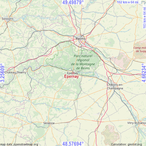
Épernay GPS coordinates[2]
49° 2' 24" North, 3° 57' 33.192" East
| Map corner | latitude | longitude |
|---|---|---|
| Upper-left | 49.49879°, | 3.25609° |
| Center: | 49.04°, | 3.95922° |
| Lower-right: | 48.57694°, | 4.66234° |
| Map W x H: | 102.5×102.5 km | = 63.7×63.7mi |
| max Lat: | 51.07786° ⇑19.4% North |
| Épernay: | 49.04° |
| min Lat: | ⇓80.6% South 41.3874° |
| min Long | Épernay | max Long |
| -5.08615° | 3.95922° | 9.52242° |
| W 67.4%⇐ | ⇒32.6% E |
Elevation
Elevation of Épernay is 123 m = 404 ft, and this is 70.7 m = 232 ft below average elevation for this country.
| Max E: |
2333 m = 7654 ft | 52.6% |
| Avg. | 193.7 m = 635 ft | |
| Épernay | 123 m = 404 ft | |
Min E: |
-1 m = -3 ft | 47.4% |
See also: France elevation on elevation.city.
Geographical zone
Épernay is located in North temperate zone (between Tropic of Cancer and the Arctic Circle). Distance of this North polar circle is 1948.4 km =1210.7 mi to North.| Distance of | km | miles | from Épernay |
|---|---|---|---|
| North Pole | 4554.3 | 2829.9 | to North |
| Arctic Circle | 1948.4 | 1210.7 | to North |
| Tropic Cancer | 2846.8 | 1768.9 | to South |
| Equator | 5452.7 | 3388.1 | to South |


Nearby cities:
15 places around Épernay: (largest is in red/bold)
• Ay
3.6 km =2.2 mi,  63°
63°
• Champillon
5.1 km =3.2 mi,  16°
16°
• Chouilly
4.3 km =2.7 mi,  112°
112°
• Cramant
6.2 km =3.9 mi,  157°
157°
• Cumières
4.3 km =2.7 mi,  327°
327°
• Damery
6.8 km =4.2 mi,  302°
302°
• Dizy
3 km =1.9 mi,  10°
10°
• Hautvillers
4.9 km =3 mi,  347°
347°
• Magenta
1.2 km =0.7 mi,  34°
34°
• Mardeuil
2.6 km =1.6 mi,  306°
306°
• Mareuil-sur-Ay
5.6 km =3.5 mi,  83°
83°
• Moussy
3.9 km =2.4 mi,  225°
225°
• Oiry
7 km =4.3 mi,  104°
104°
• Pierry
2.6 km =1.6 mi,  211°
211°
• Vinay
5.5 km =3.4 mi, 233°
Sources, notices
• [Note1] Compared only with cities in France existing in our database
• [Src1] Map data: © OpenStreetMap contributors (CC-BY-SA)
• [Src2] Other city data from geonames.org with taken over terms of usage.
• [Src3] Geographical zone / Annual Mean Temperature by Robert A. Rohde @ Wikipedia
