Cumières geodata
Cumières (Grand Est) is a populated place; located in France in Europe/Paris (GMT+2) time zone. With population of 868 people, there are 9914 cities with bigger population in this country. Compared to other cities in France, 81.4% of cities are located further ↓South; 67.2% of cities are located further ←West and 67.8% of cities have higher elevation than Cumières. Note1
Administrative division(s):
- Level 1: Grand Est
- Level 2: Marne
- Level 3: Arrondissement d'Épernay
- Level 4: Cumières


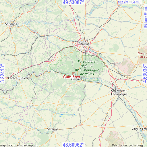
Cumières GPS coordinates[2]
49° 4' 20.568" North, 3° 55' 38.136" East
| Map corner | latitude | longitude |
|---|---|---|
| Upper-left | 49.53087°, | 3.22413° |
| Center: | 49.07238°, | 3.92726° |
| Lower-right: | 48.60962°, | 4.63038° |
| Map W x H: | 102.4×102.4 km | = 63.6×63.6mi |
| max Lat: | 51.07786° ⇑18.6% North |
| Cumières: | 49.07238° |
| min Lat: | ⇓81.4% South 41.3874° |
| min Long | Cumières | max Long |
| -5.08615° | 3.92726° | 9.52242° |
| W 67.2%⇐ | ⇒32.8% E |
Elevation
Elevation of Cumières is 83 m = 272 ft, and this is 110.7 m = 363 ft below average elevation for this country.
| Max E: |
2333 m = 7654 ft | 67.8% |
| Avg. | 193.7 m = 635 ft | |
| Cumières | 83 m = 272 ft | |
Min E: |
-1 m = -3 ft | 32.2% |
See also: France elevation on elevation.city.
Geographical zone
Cumières is located in North temperate zone (between Tropic of Cancer and the Arctic Circle). Distance of this North polar circle is 1944.8 km =1208.4 mi to North.| Distance of | km | miles | from Cumières |
|---|---|---|---|
| North Pole | 4550.7 | 2827.7 | to North |
| Arctic Circle | 1944.8 | 1208.4 | to North |
| Tropic Cancer | 2850.4 | 1771.2 | to South |
| Equator | 5456.3 | 3390.4 | to South |


Nearby cities:
15 places around Cumières: (largest is in red/bold)
• Ay
5.9 km =3.7 mi,  109°
109°
• Boursault
6.1 km =3.8 mi,  257°
257°
• Champillon
4 km =2.5 mi,  70°
70°
• Chouilly
8.2 km =5.1 mi,  129°
129°
• Damery
3.4 km =2.1 mi,  270°
270°
• Dizy
2.9 km =1.8 mi,  102°
102°
• Fleury-la-Rivière
4.2 km =2.6 mi,  310°
310°
• Hautvillers
1.8 km =1.1 mi,  45°
45°
• Magenta
4 km =2.5 mi, 130°
• Mardeuil
2.1 km =1.3 mi,  174°
174°
• Moussy
6.3 km =3.9 mi,  184°
184°
• Pierry
5.9 km =3.7 mi, 170°
• Venteuil
6.4 km =4 mi,  279°
279°
• Vinay
7.2 km =4.5 mi,  196°
196°
• Épernay
4.3 km =2.7 mi,  147°
147°
Sources, notices
• [Note1] Compared only with cities in France existing in our database
• [Src1] Map data: © OpenStreetMap contributors (CC-BY-SA)
• [Src2] Other city data from geonames.org with taken over terms of usage.
• [Src3] Geographical zone / Annual Mean Temperature by Robert A. Rohde @ Wikipedia
