Épaignes geodata
Épaignes (Normandy) is a populated place; located in France in Europe/Paris (GMT+2) time zone. With population of 1,228 people, there are 7392 cities with bigger population in this country. Compared to other cities in France, 85.7% of cities are located further ↓South; 74% of cities are located further →East and 56.8% of cities have lower elevation than Épaignes. Note1
Administrative division(s):
- Level 1: Normandy
- Level 2: Département de l'Eure
- Level 3: Arrondissement de Bernay
- Level 4: Épaignes


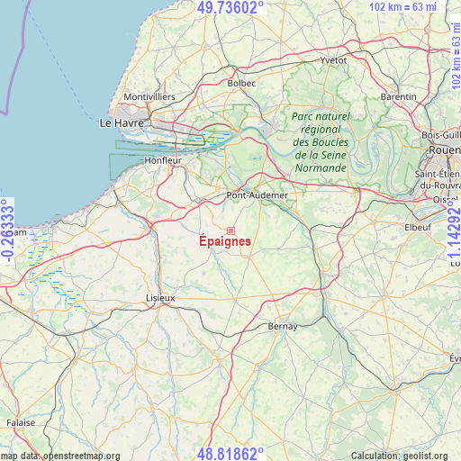
Épaignes GPS coordinates[2]
49° 16' 46.02" North, 0° 26' 23.28" East
| Map corner | latitude | longitude |
|---|---|---|
| Upper-left | 49.73602°, | -0.26333° |
| Center: | 49.27945°, | 0.4398° |
| Lower-right: | 48.81862°, | 1.14292° |
| Map W x H: | 102×102 km | = 63.4×63.4mi |
| max Lat: | 51.07786° ⇑14.3% North |
| Épaignes: | 49.27945° |
| min Lat: | ⇓85.7% South 41.3874° |
| min Long | Épaignes | max Long |
| -5.08615° | 0.4398° | 9.52242° |
| W 26%⇐ | ⇒74% E |
Elevation
Elevation of Épaignes is 157 m = 515 ft, and this is 36.7 m = 120 ft below average elevation for this country.
| Max E: |
2333 m = 7654 ft | 43.2% |
| Avg. | 193.7 m = 635 ft | |
| Épaignes | 157 m = 515 ft | |
Min E: |
-1 m = -3 ft | 56.8% |
See also: France elevation on elevation.city.
Geographical zone
Épaignes is located in North temperate zone (between Tropic of Cancer and the Arctic Circle). Distance of this North polar circle is 1921.8 km =1194.2 mi to North.| Distance of | km | miles | from Épaignes |
|---|---|---|---|
| North Pole | 4527.7 | 2813.4 | to North |
| Arctic Circle | 1921.8 | 1194.2 | to North |
| Tropic Cancer | 2873.4 | 1785.4 | to South |
| Equator | 5479.4 | 3404.7 | to South |


Nearby cities:
15 places around Épaignes: (largest is in red/bold)
• Beuzeville
10.1 km =6.3 mi,  315°
315°
• Bonneville-la-Louvet
7.9 km =4.9 mi,  263°
263°
• Boulleville
10.8 km =6.7 mi,  340°
340°
• Campigny
9 km =5.6 mi,  67°
67°
• Cormeilles
5.8 km =3.6 mi,  232°
232°
• Le Pin
10.8 km =6.7 mi, 225°
• Lieurey
7 km =4.3 mi,  141°
141°
• Manneville-sur-Risle
11.1 km =6.9 mi,  43°
43°
• Moyaux
11.2 km =7 mi,  212°
212°
• Pont-Audemer
9.6 km =6 mi, 35°
• Saint-Georges-du-Vièvre
11.3 km =7 mi,  110°
110°
• Saint-Germain-Village
9 km =5.6 mi,  30°
30°
• Saint-Mards-de-Blacarville
11.7 km =7.3 mi, 30°
• Tourville-sur-Pont-Audemer
7.6 km =4.7 mi,  45°
45°
• Toutainville
9.7 km =6 mi,  11°
11°
Sources, notices
• [Note1] Compared only with cities in France existing in our database
• [Src1] Map data: © OpenStreetMap contributors (CC-BY-SA)
• [Src2] Other city data from geonames.org with taken over terms of usage.
• [Src3] Geographical zone / Annual Mean Temperature by Robert A. Rohde @ Wikipedia
