Lapte geodata
Lapte (Auvergne-Rhône-Alpes) is a populated place; located in France in Europe/Paris (GMT+2) time zone. With population of 1,330 people, there are 6894 cities with bigger population in this country. Compared to other cities in France, 77.6% of cities are located further ↑North; 69.9% of cities are located further ←West and 98.3% of cities have lower elevation than Lapte. Note1
Administrative division(s):
- Level 1: Auvergne-Rhône-Alpes
- Level 2: Haute-Loire
- Level 3: Yssingeaux
- Level 4: Lapte


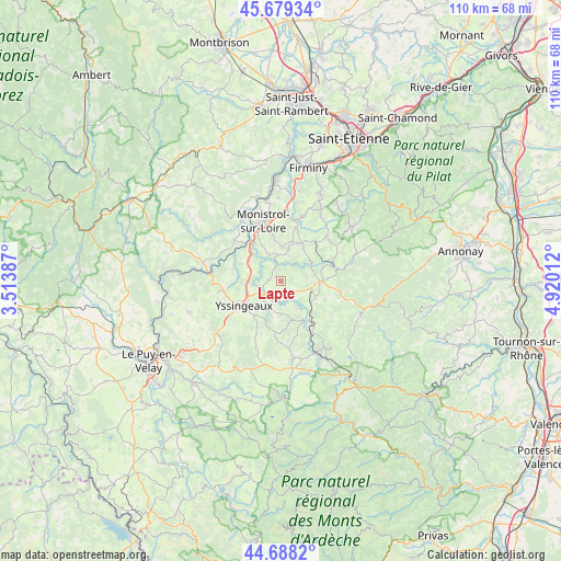
Lapte GPS coordinates[2]
45° 11' 9.348" North, 4° 13' 1.164" East
| Map corner | latitude | longitude |
|---|---|---|
| Upper-left | 45.67934°, | 3.51387° |
| Center: | 45.18593°, | 4.21699° |
| Lower-right: | 44.6882°, | 4.92012° |
| Map W x H: | 110.2×110.2 km | = 68.5×68.5mi |
| max Lat: | 51.07786° ⇑77.6% North |
| Lapte: | 45.18593° |
| min Lat: | ⇓22.4% South 41.3874° |
| min Long | Lapte | max Long |
| -5.08615° | 4.21699° | 9.52242° |
| W 69.9%⇐ | ⇒30.1% E |
Elevation
Elevation of Lapte is 865 m = 2838 ft, and this is 671.3 m = 2202 ft above average elevation for this country.
| Max E: |
2333 m = 7654 ft | 1.7% |
| Lapte | 865 m 2838 ft | |
| Avg. | 193.7 m = 635 ft | |
Min E: |
-1 m = -3 ft | 98.3% |
See also: France elevation on elevation.city.
Geographical zone
Lapte is located in North temperate zone (between Tropic of Cancer and the Arctic Circle). Distance of this North polar circle is 2377 km =1477 mi to North.| Distance of | km | miles | from Lapte |
|---|---|---|---|
| North Pole | 4982.9 | 3096.2 | to North |
| Arctic Circle | 2377 | 1477 | to North |
| Tropic Cancer | 2418.3 | 1502.7 | to South |
| Equator | 5024.2 | 3121.9 | to South |


Nearby cities:
15 places around Lapte: (largest is in red/bold)
• Araules
11.2 km =7 mi,  197°
197°
• Beaux
9.7 km =6 mi,  270°
270°
• Beauzac
12.3 km =7.6 mi,  311°
311°
• Dunières
10.5 km =6.5 mi,  71°
71°
• Les Villettes
6.1 km =3.8 mi,  334°
334°
• Monistrol-sur-Loire
12.4 km =7.7 mi,  343°
343°
• Montfaucon-en-Velay
7.6 km =4.7 mi,  90°
90°
• Montregard
10.6 km =6.6 mi,  106°
106°
• Raucoules
6.1 km =3.8 mi, 88°
• Saint-Jeures
10 km =6.2 mi,  185°
185°
• Saint-Maurice-de-Lignon
7.5 km =4.7 mi,  304°
304°
• Saint-Pal-de-Mons
8.1 km =5 mi,  33°
33°
• Sainte-Sigolène
6.5 km =4 mi,  11°
11°
• Tence
9.9 km =6.2 mi,  143°
143°
• Yssingeaux
8.7 km =5.4 mi,  236°
236°
Sources, notices
• [Note1] Compared only with cities in France existing in our database
• [Src1] Map data: © OpenStreetMap contributors (CC-BY-SA)
• [Src2] Other city data from geonames.org with taken over terms of usage.
• [Src3] Geographical zone / Annual Mean Temperature by Robert A. Rohde @ Wikipedia
