Drain geodata
Drain (Pays de la Loire) is a populated place; located in France in Europe/Paris (GMT+2) time zone. With population of 1,757 people, there are 5389 cities with bigger population in this country. Compared to other cities in France, 51% of cities are located further ↑North; 90.1% of cities are located further →East and 69.7% of cities have higher elevation than Drain. Note1
Administrative division(s):
- Level 1: Pays de la Loire
- Level 2: Département de Maine-et-Loire
- Level 3: Arrondissement de Cholet
- Level 4: Orée d'Anjou


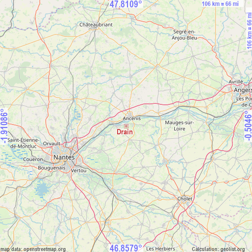
Drain GPS coordinates[2]
47° 20' 11.58" North, 1° 12' 27.828" West
| Map corner | latitude | longitude |
|---|---|---|
| Upper-left | 47.8109°, | -1.91086° |
| Center: | 47.33655°, | -1.20773° |
| Lower-right: | 46.8579°, | -0.5046° |
| Map W x H: | 106×106 km | = 65.9×65.9mi |
| max Lat: | 51.07786° ⇑51% North |
| Drain: | 47.33655° |
| min Lat: | ⇓49% South 41.3874° |
| min Long | Drain | max Long |
| -5.08615° | -1.20773° | 9.52242° |
| W 9.9%⇐ | ⇒90.1% E |
Elevation
Elevation of Drain is 79 m = 259 ft, and this is 114.7 m = 376 ft below average elevation for this country.
| Max E: |
2333 m = 7654 ft | 69.7% |
| Avg. | 193.7 m = 635 ft | |
| Drain | 79 m = 259 ft | |
Min E: |
-1 m = -3 ft | 30.3% |
See also: France elevation on elevation.city.
Geographical zone
Drain is located in North temperate zone (between Tropic of Cancer and the Arctic Circle). Distance of this North polar circle is 2137.8 km =1328.4 mi to North.| Distance of | km | miles | from Drain |
|---|---|---|---|
| North Pole | 4743.7 | 2947.6 | to North |
| Arctic Circle | 2137.8 | 1328.4 | to North |
| Tropic Cancer | 2657.4 | 1651.2 | to South |
| Equator | 5263.3 | 3270.5 | to South |


Nearby cities:
15 places around Drain: (largest is in red/bold)
• Ancenis
4.6 km =2.9 mi,  42°
42°
• Anetz
9.1 km =5.7 mi,  57°
57°
• Barbechat
8.8 km =5.5 mi,  221°
221°
• Bouzillé
7.3 km =4.5 mi,  89°
89°
• Champtoceaux
4 km =2.5 mi,  267°
267°
• Couffé
8.9 km =5.5 mi,  313°
313°
• La Varenne
8.9 km =5.5 mi,  251°
251°
• Landemont
8.3 km =5.2 mi,  197°
197°
• Le Cellier
10.6 km =6.6 mi,  259°
259°
• Le Fuilet
9.3 km =5.8 mi,  129°
129°
• Le Marillais
10.1 km =6.3 mi,  76°
76°
• Liré
3.3 km =2.1 mi, 76°
• Oudon
6 km =3.7 mi,  282°
282°
• Saint-Géréon
3.5 km =2.2 mi,  6°
6°
• Saint-Laurent-des-Autels
5.9 km =3.7 mi,  165°
165°
Sources, notices
• [Note1] Compared only with cities in France existing in our database
• [Src1] Map data: © OpenStreetMap contributors (CC-BY-SA)
• [Src2] Other city data from geonames.org with taken over terms of usage.
• [Src3] Geographical zone / Annual Mean Temperature by Robert A. Rohde @ Wikipedia
