Liré geodata
Liré (Pays de la Loire) is a populated place; located in France in Europe/Paris (GMT+2) time zone. With population of 2,365 people, there are 4085 cities with bigger population in this country. Compared to other cities in France, 50.9% of cities are located further ↑North; 89.7% of cities are located further →East and 85.9% of cities have higher elevation than Liré. Note1
Administrative division(s):
- Level 1: Pays de la Loire
- Level 2: Département de Maine-et-Loire
- Level 3: Arrondissement de Cholet
- Level 4: Orée d'Anjou


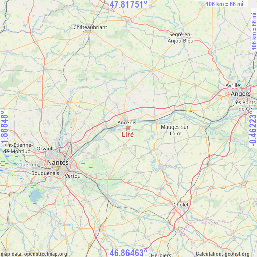
Liré GPS coordinates[2]
47° 20' 35.592" North, 1° 9' 55.296" West
| Map corner | latitude | longitude |
|---|---|---|
| Upper-left | 47.81751°, | -1.86848° |
| Center: | 47.34322°, | -1.16536° |
| Lower-right: | 46.86463°, | -0.46223° |
| Map W x H: | 106×105.9 km | = 65.9×65.8mi |
| max Lat: | 51.07786° ⇑50.9% North |
| Liré: | 47.34322° |
| min Lat: | ⇓49.1% South 41.3874° |
| min Long | Liré | max Long |
| -5.08615° | -1.16536° | 9.52242° |
| W 10.3%⇐ | ⇒89.7% E |
Elevation
Elevation of Liré is 40 m = 131 ft, and this is 153.7 m = 504 ft below average elevation for this country.
| Max E: |
2333 m = 7654 ft | 85.9% |
| Avg. | 193.7 m = 635 ft | |
| Liré | 40 m = 131 ft | |
Min E: |
-1 m = -3 ft | 14.1% |
See also: France elevation on elevation.city.
Geographical zone
Liré is located in North temperate zone (between Tropic of Cancer and the Arctic Circle). Distance of this North polar circle is 2137.1 km =1327.9 mi to North.| Distance of | km | miles | from Liré |
|---|---|---|---|
| North Pole | 4743 | 2947.2 | to North |
| Arctic Circle | 2137.1 | 1327.9 | to North |
| Tropic Cancer | 2658.2 | 1651.7 | to South |
| Equator | 5264.1 | 3271 | to South |


Nearby cities:
15 places around Liré: (largest is in red/bold)
• Ancenis
2.6 km =1.6 mi,  357°
357°
• Anetz
6.1 km =3.8 mi,  47°
47°
• Bouzillé
4.1 km =2.5 mi,  98°
98°
• Champtoceaux
7.3 km =4.5 mi,  262°
262°
• Drain
3.3 km =2.1 mi, 256°
• La Chapelle-Saint-Florent
8.3 km =5.2 mi, 97°
• Landemont
10.3 km =6.4 mi,  212°
212°
• Le Fuilet
7.7 km =4.8 mi,  149°
149°
• Le Marillais
6.8 km =4.2 mi,  76°
76°
• Mésanger
10.9 km =6.8 mi,  334°
334°
• Oudon
9 km =5.6 mi,  273°
273°
• Saint-Géréon
3.9 km =2.4 mi,  314°
314°
• Saint-Herblon
8.8 km =5.5 mi,  35°
35°
• Saint-Laurent-des-Autels
6.7 km =4.2 mi,  195°
195°
• Saint-Rémy-en-Mauges
10.4 km =6.5 mi,  139°
139°
Sources, notices
• [Note1] Compared only with cities in France existing in our database
• [Src1] Map data: © OpenStreetMap contributors (CC-BY-SA)
• [Src2] Other city data from geonames.org with taken over terms of usage.
• [Src3] Geographical zone / Annual Mean Temperature by Robert A. Rohde @ Wikipedia
