Dommartin-lès-Toul geodata
Dommartin-lès-Toul (Grand Est) is a populated place; located in France in Europe/Paris (GMT+2) time zone. With population of 1,688 people, there are 5552 cities with bigger population in this country. Compared to other cities in France, 72.5% of cities are located further ↓South; 86% of cities are located further ←West and 70.1% of cities have lower elevation than Dommartin-lès-Toul. Note1
Administrative division(s):
- Level 1: Grand Est
- Level 2: Meurthe-et-Moselle
- Level 3: Arrondissement de Toul
- Level 4: Dommartin-lès-Toul


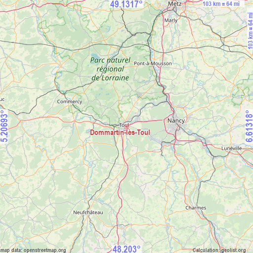
Dommartin-lès-Toul GPS coordinates[2]
48° 40' 10.164" North, 5° 54' 36.18" East
| Map corner | latitude | longitude |
|---|---|---|
| Upper-left | 49.1317°, | 5.20693° |
| Center: | 48.66949°, | 5.91005° |
| Lower-right: | 48.203°, | 6.61318° |
| Map W x H: | 103.3×103.3 km | = 64.2×64.2mi |
| max Lat: | 51.07786° ⇑27.5% North |
| Dommartin-lès-Toul: | 48.66949° |
| min Lat: | ⇓72.5% South 41.3874° |
| min Long | Dommartin-lès- | max Long |
| -5.08615° | 5.91005° | 9.52242° |
| W 86%⇐ | ⇒14% E |
Elevation
Elevation of Dommartin-lès-Toul is 220 m = 722 ft, and this is 26.3 m = 86 ft above average elevation for this country.
| Max E: |
2333 m = 7654 ft | 29.9% |
| Dommartin-lès-Toul | 220 m 722 ft | |
| Avg. | 193.7 m = 635 ft | |
Min E: |
-1 m = -3 ft | 70.1% |
See also: France elevation on elevation.city.
Geographical zone
Dommartin-lès-Toul is located in North temperate zone (between Tropic of Cancer and the Arctic Circle). Distance of this North polar circle is 1989.6 km =1236.3 mi to North.| Distance of | km | miles | from Dommartin-lès-Toul |
|---|---|---|---|
| North Pole | 4595.5 | 2855.5 | to North |
| Arctic Circle | 1989.6 | 1236.3 | to North |
| Tropic Cancer | 2805.6 | 1743.3 | to South |
| Equator | 5411.5 | 3362.5 | to South |


Nearby cities:
15 places around Dommartin-lès-Toul: (largest is in red/bold)
• Bicqueley
4.8 km =3 mi,  178°
178°
• Blénod-lès-Toul
9.5 km =5.9 mi,  214°
214°
• Bruley
5.9 km =3.7 mi,  314°
314°
• Chaudeney-sur-Moselle
1.9 km =1.2 mi,  186°
186°
• Choloy-Ménillot
6.9 km =4.3 mi,  267°
267°
• Domgermain
6.6 km =4.1 mi,  243°
243°
• Foug
9.1 km =5.7 mi,  280°
280°
• Gondreville
4.8 km =3 mi,  56°
56°
• Lucey
7.8 km =4.8 mi,  318°
318°
• Pagney-derrière-Barine
5.4 km =3.4 mi,  298°
298°
• Pierre-la-Treiche
3.4 km =2.1 mi,  149°
149°
• Toul
1.9 km =1.2 mi, 312°
• Velaine-en-Haye
9.3 km =5.8 mi,  68°
68°
• Villey-Saint-Étienne
8.6 km =5.3 mi,  35°
35°
• Écrouves
5.1 km =3.2 mi, 283°
Sources, notices
• [Note1] Compared only with cities in France existing in our database
• [Src1] Map data: © OpenStreetMap contributors (CC-BY-SA)
• [Src2] Other city data from geonames.org with taken over terms of usage.
• [Src3] Geographical zone / Annual Mean Temperature by Robert A. Rohde @ Wikipedia
