Blénod-lès-Toul geodata
Blénod-lès-Toul (Grand Est) is a populated place; located in France in Europe/Paris (GMT+2) time zone. With population of 1,033 people, there are 8590 cities with bigger population in this country. Compared to other cities in France, 70.8% of cities are located further ↓South; 85.4% of cities are located further ←West and 76.9% of cities have lower elevation than Blénod-lès-Toul. Note1
Administrative division(s):
- Level 1: Grand Est
- Level 2: Meurthe-et-Moselle
- Level 3: Arrondissement de Toul
- Level 4: Blénod-lès-Toul


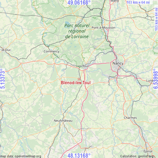
Blénod-lès-Toul GPS coordinates[2]
48° 35' 55.752" North, 5° 50' 12.66" East
| Map corner | latitude | longitude |
|---|---|---|
| Upper-left | 49.06168°, | 5.13373° |
| Center: | 48.59882°, | 5.83685° |
| Lower-right: | 48.13168°, | 6.53998° |
| Map W x H: | 103.4×103.4 km | = 64.2×64.2mi |
| max Lat: | 51.07786° ⇑29.2% North |
| Blénod-lès-Toul: | 48.59882° |
| min Lat: | ⇓70.8% South 41.3874° |
| min Long | Blénod-lès-To | max Long |
| -5.08615° | 5.83685° | 9.52242° |
| W 85.4%⇐ | ⇒14.6% E |
Elevation
Elevation of Blénod-lès-Toul is 263 m = 863 ft, and this is 69.3 m = 227 ft above average elevation for this country.
| Max E: |
2333 m = 7654 ft | 23.1% |
| Blénod-lès-Toul | 263 m 863 ft | |
| Avg. | 193.7 m = 635 ft | |
Min E: |
-1 m = -3 ft | 76.9% |
See also: France elevation on elevation.city.
Geographical zone
Blénod-lès-Toul is located in North temperate zone (between Tropic of Cancer and the Arctic Circle). Distance of this North polar circle is 1997.5 km =1241.2 mi to North.| Distance of | km | miles | from Blénod-lès-Toul |
|---|---|---|---|
| North Pole | 4603.4 | 2860.4 | to North |
| Arctic Circle | 1997.5 | 1241.2 | to North |
| Tropic Cancer | 2797.8 | 1738.5 | to South |
| Equator | 5403.7 | 3357.7 | to South |


Nearby cities:
15 places around Blénod-lès-Toul: (largest is in red/bold)
• Allamps
6.1 km =3.8 mi,  199°
199°
• Bicqueley
6.3 km =3.9 mi,  61°
61°
• Bruley
12.1 km =7.5 mi,  5°
5°
• Chaudeney-sur-Moselle
7.9 km =4.9 mi,  40°
40°
• Choloy-Ménillot
7.7 km =4.8 mi,  348°
348°
• Colombey-les-Belles
8.8 km =5.5 mi,  151°
151°
• Domgermain
4.9 km =3 mi, 353°
• Dommartin-lès-Toul
9.5 km =5.9 mi,  34°
34°
• Foug
10.1 km =6.3 mi,  338°
338°
• Pagney-derrière-Barine
10.5 km =6.5 mi,  3°
3°
• Pierre-la-Treiche
8.7 km =5.4 mi, 55°
• Thuilley-aux-Groseilles
10.3 km =6.4 mi,  105°
105°
• Toul
9.9 km =6.2 mi,  23°
23°
• Vannes-le-Châtel
7 km =4.3 mi,  213°
213°
• Écrouves
9 km =5.6 mi, 2°
Sources, notices
• [Note1] Compared only with cities in France existing in our database
• [Src1] Map data: © OpenStreetMap contributors (CC-BY-SA)
• [Src2] Other city data from geonames.org with taken over terms of usage.
• [Src3] Geographical zone / Annual Mean Temperature by Robert A. Rohde @ Wikipedia
