Domats geodata
Domats (Bourgogne-Franche-Comté) is a populated place; located in France in Europe/Paris (GMT+2) time zone. With population of 620 people, there are 12983 cities with bigger population in this country. Compared to other cities in France, 61.4% of cities are located further ↓South; 58.8% of cities are located further ←West and 58.7% of cities have lower elevation than Domats. Note1
Administrative division(s):
- Level 1: Bourgogne-Franche-Comté
- Level 2: Département de l'Yonne
- Level 3: Arrondissement de Sens
- Level 4: Domats


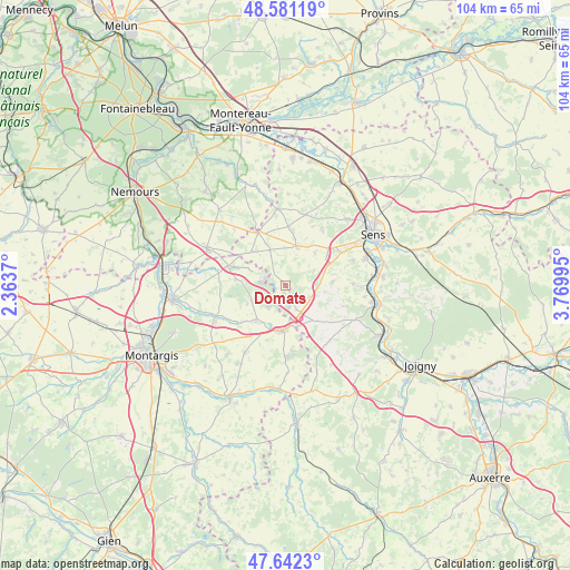
Domats GPS coordinates[2]
48° 6' 50.004" North, 3° 4' 0.552" East
| Map corner | latitude | longitude |
|---|---|---|
| Upper-left | 48.58119°, | 2.3637° |
| Center: | 48.11389°, | 3.06682° |
| Lower-right: | 47.6423°, | 3.76995° |
| Map W x H: | 104.4×104.4 km | = 64.9×64.9mi |
| max Lat: | 51.07786° ⇑38.6% North |
| Domats: | 48.11389° |
| min Lat: | ⇓61.4% South 41.3874° |
| min Long | Domats | max Long |
| -5.08615° | 3.06682° | 9.52242° |
| W 58.8%⇐ | ⇒41.2% E |
Elevation
Elevation of Domats is 164 m = 538 ft, and this is 29.7 m = 97 ft below average elevation for this country.
| Max E: |
2333 m = 7654 ft | 41.3% |
| Avg. | 193.7 m = 635 ft | |
| Domats | 164 m = 538 ft | |
Min E: |
-1 m = -3 ft | 58.7% |
See also: France elevation on elevation.city.
Geographical zone
Domats is located in North temperate zone (between Tropic of Cancer and the Arctic Circle). Distance of this North polar circle is 2051.4 km =1274.7 mi to North.| Distance of | km | miles | from Domats |
|---|---|---|---|
| North Pole | 4657.3 | 2893.9 | to North |
| Arctic Circle | 2051.4 | 1274.7 | to North |
| Tropic Cancer | 2743.8 | 1704.9 | to South |
| Equator | 5349.8 | 3324.2 | to South |


Nearby cities:
15 places around Domats: (largest is in red/bold)
• Bazoches-sur-le-Betz
6.2 km =3.9 mi,  290°
290°
• Brannay
13.4 km =8.3 mi,  16°
16°
• Chaumot
11.9 km =7.4 mi,  108°
108°
• Chuelles
14.5 km =9 mi,  211°
211°
• Chéroy
10.9 km =6.8 mi,  332°
332°
• Collemiers
13.2 km =8.2 mi,  69°
69°
• Courtenay
8.3 km =5.2 mi,  184°
184°
• La Selle-sur-le-Bied
13.8 km =8.6 mi,  246°
246°
• Marsangy
14.2 km =8.8 mi,  91°
91°
• Montacher-Villegardin
6.4 km =4 mi,  337°
337°
• Paron
15.4 km =9.6 mi,  62°
62°
• Piffonds
8.9 km =5.5 mi,  137°
137°
• Saint-Hilaire-les-Andrésis
7.9 km =4.9 mi, 210°
• Saint-Valérien
7.4 km =4.6 mi, 16°
• Égriselles-le-Bocage
8.6 km =5.3 mi,  84°
84°
Sources, notices
• [Note1] Compared only with cities in France existing in our database
• [Src1] Map data: © OpenStreetMap contributors (CC-BY-SA)
• [Src2] Other city data from geonames.org with taken over terms of usage.
• [Src3] Geographical zone / Annual Mean Temperature by Robert A. Rohde @ Wikipedia
