La Selle-sur-le-Bied geodata
La Selle-sur-le-Bied (Centre) is a populated place; located in France in Europe/Paris (GMT+2) time zone. With population of 826 people, there are 10332 cities with bigger population in this country. Compared to other cities in France, 60.5% of cities are located further ↓South; 56.4% of cities are located further ←West and 57.6% of cities have higher elevation than La Selle-sur-le-Bied. Note1
Administrative division(s):
- Level 1: Centre
- Level 2: Loiret
- Level 3: Arrondissement de Montargis
- Level 4: La Selle-sur-le-Bied


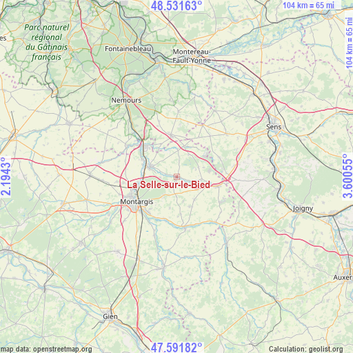
La Selle-sur-le-Bied GPS coordinates[2]
48° 3' 49.932" North, 2° 53' 50.712" East
| Map corner | latitude | longitude |
|---|---|---|
| Upper-left | 48.53163°, | 2.1943° |
| Center: | 48.06387°, | 2.89742° |
| Lower-right: | 47.59182°, | 3.60055° |
| Map W x H: | 104.5×104.5 km | = 64.9×64.9mi |
| max Lat: | 51.07786° ⇑39.5% North |
| La Selle-sur-le-Bied: | 48.06387° |
| min Lat: | ⇓60.5% South 41.3874° |
| min Long | La Selle-sur-le | max Long |
| -5.08615° | 2.89742° | 9.52242° |
| W 56.4%⇐ | ⇒43.6% E |
Elevation
Elevation of La Selle-sur-le-Bied is 109 m = 358 ft, and this is 84.7 m = 278 ft below average elevation for this country.
| Max E: |
2333 m = 7654 ft | 57.6% |
| Avg. | 193.7 m = 635 ft | |
| La Selle-sur-le-Bied | 109 m = 358 ft | |
Min E: |
-1 m = -3 ft | 42.4% |
See also: France elevation on elevation.city.
Geographical zone
La Selle-sur-le-Bied is located in North temperate zone (between Tropic of Cancer and the Arctic Circle). Distance of this North polar circle is 2057 km =1278.2 mi to North.| Distance of | km | miles | from La Selle-sur-le-Bied |
|---|---|---|---|
| North Pole | 4662.9 | 2897.4 | to North |
| Arctic Circle | 2057 | 1278.2 | to North |
| Tropic Cancer | 2738.3 | 1701.5 | to South |
| Equator | 5344.2 | 3320.7 | to South |


Nearby cities:
15 places around La Selle-sur-le-Bied: (largest is in red/bold)
• Bazoches-sur-le-Betz
10.2 km =6.3 mi,  41°
41°
• Bransles
11 km =6.8 mi,  333°
333°
• Cepoy
12 km =7.5 mi,  261°
261°
• Chuelles
8.5 km =5.3 mi,  143°
143°
• Châlette-sur-Loing
13.3 km =8.3 mi,  244°
244°
• Courtenay
12.3 km =7.6 mi,  102°
102°
• Dordives
13 km =8.1 mi,  312°
312°
• Fontenay-sur-Loing
10.1 km =6.3 mi,  296°
296°
• Griselles
5.5 km =3.4 mi,  292°
292°
• La Selle-en-Hermoy
5.8 km =3.6 mi,  181°
181°
• Nargis
11.7 km =7.3 mi, 296°
• Paucourt
8.1 km =5 mi,  249°
249°
• Saint-Germain-des-Prés
12.8 km =8 mi,  196°
196°
• Saint-Hilaire-les-Andrésis
8.7 km =5.4 mi, 98°
• Égreville
12.6 km =7.8 mi,  351°
351°
Sources, notices
• [Note1] Compared only with cities in France existing in our database
• [Src1] Map data: © OpenStreetMap contributors (CC-BY-SA)
• [Src2] Other city data from geonames.org with taken over terms of usage.
• [Src3] Geographical zone / Annual Mean Temperature by Robert A. Rohde @ Wikipedia
