Domagné geodata
Domagné (Brittany) is a populated place; located in France in Europe/Paris (GMT+2) time zone. With population of 1,794 people, there are 5295 cities with bigger population in this country. Compared to other cities in France, 60.6% of cities are located further ↓South; 91.5% of cities are located further →East and 68.7% of cities have higher elevation than Domagné. Note1
Administrative division(s):
- Level 1: Brittany
- Level 2: Département d'Ille-et-Vilaine
- Level 3: Arrondissement de Fougères-Vitré
- Level 4: Domagné


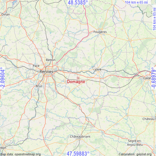
Domagné GPS coordinates[2]
48° 4' 14.916" North, 1° 23' 34.476" West
| Map corner | latitude | longitude |
|---|---|---|
| Upper-left | 48.5385°, | -2.09604° |
| Center: | 48.07081°, | -1.39291° |
| Lower-right: | 47.59883°, | -0.68979° |
| Map W x H: | 104.5×104.5 km | = 64.9×64.9mi |
| max Lat: | 51.07786° ⇑39.4% North |
| Domagné: | 48.07081° |
| min Lat: | ⇓60.6% South 41.3874° |
| min Long | Domagné | max Long |
| -5.08615° | -1.39291° | 9.52242° |
| W 8.5%⇐ | ⇒91.5% E |
Elevation
Elevation of Domagné is 81 m = 266 ft, and this is 112.7 m = 370 ft below average elevation for this country.
| Max E: |
2333 m = 7654 ft | 68.7% |
| Avg. | 193.7 m = 635 ft | |
| Domagné | 81 m = 266 ft | |
Min E: |
-1 m = -3 ft | 31.3% |
See also: France elevation on elevation.city.
Geographical zone
Domagné is located in North temperate zone (between Tropic of Cancer and the Arctic Circle). Distance of this North polar circle is 2056.2 km =1277.7 mi to North.| Distance of | km | miles | from Domagné |
|---|---|---|---|
| North Pole | 4662.1 | 2896.9 | to North |
| Arctic Circle | 2056.2 | 1277.7 | to North |
| Tropic Cancer | 2739.1 | 1702 | to South |
| Equator | 5345 | 3321.2 | to South |


Nearby cities:
15 places around Domagné: (largest is in red/bold)
• Brécé
7.8 km =4.8 mi,  302°
302°
• Châteaubourg
4.5 km =2.8 mi,  353°
353°
• Châteaugiron
8.7 km =5.4 mi,  251°
251°
• Cornillé
6.4 km =4 mi,  79°
79°
• Louvigné-de-Bais
5.2 km =3.2 mi,  117°
117°
• Marpiré
8.8 km =5.5 mi,  26°
26°
• Moulins
7.7 km =4.8 mi,  168°
168°
• Ossé
4.6 km =2.9 mi, 248°
• Piré-sur-Seiche
7.3 km =4.5 mi,  201°
201°
• Saint-Aubin-des-Landes
7.7 km =4.8 mi,  69°
69°
• Saint-Aubin-du-Pavail
6 km =3.7 mi,  239°
239°
• Saint-Didier
3.1 km =1.9 mi, 29°
• Saint-Jean-sur-Vilaine
5.6 km =3.5 mi,  24°
24°
• Servon-sur-Vilaine
7.5 km =4.7 mi,  318°
318°
• Torcé
9.4 km =5.8 mi,  96°
96°
Sources, notices
• [Note1] Compared only with cities in France existing in our database
• [Src1] Map data: © OpenStreetMap contributors (CC-BY-SA)
• [Src2] Other city data from geonames.org with taken over terms of usage.
• [Src3] Geographical zone / Annual Mean Temperature by Robert A. Rohde @ Wikipedia
