Danizy geodata
Danizy (Hauts-de-France) is a populated place; located in France in Europe/Paris (GMT+2) time zone. With population of 566 people, there are 13895 cities with bigger population in this country. Compared to other cities in France, 91.3% of cities are located further ↓South; 63.1% of cities are located further ←West and 70.5% of cities have higher elevation than Danizy. Note1
Administrative division(s):
- Level 1: Hauts-de-France
- Level 2: Département de l'Aisne
- Level 3: Arrondissement de Laon
- Level 4: Danizy


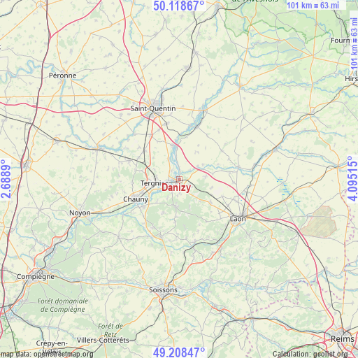
Danizy GPS coordinates[2]
49° 39' 56.52" North, 3° 23' 31.272" East
| Map corner | latitude | longitude |
|---|---|---|
| Upper-left | 50.11867°, | 2.6889° |
| Center: | 49.6657°, | 3.39202° |
| Lower-right: | 49.20847°, | 4.09515° |
| Map W x H: | 101.2×101.2 km | = 62.9×62.9mi |
| max Lat: | 51.07786° ⇑8.7% North |
| Danizy: | 49.6657° |
| min Lat: | ⇓91.3% South 41.3874° |
| min Long | Danizy | max Long |
| -5.08615° | 3.39202° | 9.52242° |
| W 63.1%⇐ | ⇒36.9% E |
Elevation
Elevation of Danizy is 77 m = 253 ft, and this is 116.7 m = 383 ft below average elevation for this country.
| Max E: |
2333 m = 7654 ft | 70.5% |
| Avg. | 193.7 m = 635 ft | |
| Danizy | 77 m = 253 ft | |
Min E: |
-1 m = -3 ft | 29.5% |
See also: France elevation on elevation.city.
Geographical zone
Danizy is located in North temperate zone (between Tropic of Cancer and the Arctic Circle). Distance of this North polar circle is 1878.9 km =1167.5 mi to North.| Distance of | km | miles | from Danizy |
|---|---|---|---|
| North Pole | 4484.8 | 2786.7 | to North |
| Arctic Circle | 1878.9 | 1167.5 | to North |
| Tropic Cancer | 2916.4 | 1812.2 | to South |
| Equator | 5522.3 | 3431.4 | to South |


Nearby cities:
15 places around Danizy: (largest is in red/bold)
• Achery
3.1 km =1.9 mi,  357°
357°
• Amigny-Rouy
8.9 km =5.5 mi,  225°
225°
• Barisis
10.1 km =6.3 mi,  204°
204°
• Beautor
3.7 km =2.3 mi,  246°
246°
• Bertaucourt-Epourdon
5.5 km =3.4 mi,  186°
186°
• Charmes
1.7 km =1.1 mi,  215°
215°
• Condren
8.9 km =5.5 mi,  243°
243°
• Couvron-et-Aumencourt
9.4 km =5.8 mi,  104°
104°
• Frières-Faillouël
11 km =6.8 mi,  283°
283°
• La Fère
1.9 km =1.2 mi,  260°
260°
• Nouvion-et-Catillon
7.8 km =4.8 mi,  58°
58°
• Saint-Gobain
7.9 km =4.9 mi, 187°
• Tergnier
6.6 km =4.1 mi, 260°
• Travecy
3.4 km =2.1 mi,  314°
314°
• Vendeuil
6.2 km =3.9 mi,  332°
332°
Sources, notices
• [Note1] Compared only with cities in France existing in our database
• [Src1] Map data: © OpenStreetMap contributors (CC-BY-SA)
• [Src2] Other city data from geonames.org with taken over terms of usage.
• [Src3] Geographical zone / Annual Mean Temperature by Robert A. Rohde @ Wikipedia
