Charmes geodata
Charmes (Hauts-de-France) is a populated place; located in France in Europe/Paris (GMT+2) time zone. With population of 1,806 people, there are 5252 cities with bigger population in this country. Compared to other cities in France, 91.1% of cities are located further ↓South; 62.9% of cities are located further ←West and 79.8% of cities have higher elevation than Charmes. Note1
Administrative division(s):
- Level 1: Hauts-de-France
- Level 2: Département de l'Aisne
- Level 3: Arrondissement de Laon
- Level 4: Charmes


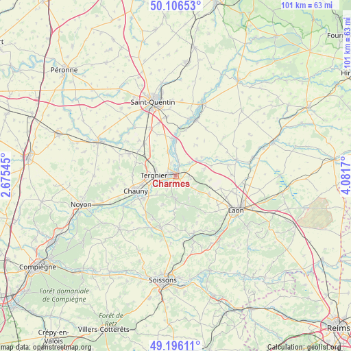
Charmes GPS coordinates[2]
49° 39' 12.42" North, 3° 22' 42.852" East
| Map corner | latitude | longitude |
|---|---|---|
| Upper-left | 50.10653°, | 2.67545° |
| Center: | 49.65345°, | 3.37857° |
| Lower-right: | 49.19611°, | 4.0817° |
| Map W x H: | 101.2×101.2 km | = 62.9×62.9mi |
| max Lat: | 51.07786° ⇑8.9% North |
| Charmes: | 49.65345° |
| min Lat: | ⇓91.1% South 41.3874° |
| min Long | Charmes | max Long |
| -5.08615° | 3.37857° | 9.52242° |
| W 62.9%⇐ | ⇒37.1% E |
Elevation
Elevation of Charmes is 55 m = 180 ft, and this is 138.7 m = 455 ft below average elevation for this country.
| Max E: |
2333 m = 7654 ft | 79.8% |
| Avg. | 193.7 m = 635 ft | |
| Charmes | 55 m = 180 ft | |
Min E: |
-1 m = -3 ft | 20.2% |
See also: France elevation on elevation.city.
Geographical zone
Charmes is located in North temperate zone (between Tropic of Cancer and the Arctic Circle). Distance of this North polar circle is 1880.2 km =1168.3 mi to North.| Distance of | km | miles | from Charmes |
|---|---|---|---|
| North Pole | 4486.1 | 2787.5 | to North |
| Arctic Circle | 1880.2 | 1168.3 | to North |
| Tropic Cancer | 2915 | 1811.3 | to South |
| Equator | 5520.9 | 3430.5 | to South |


Nearby cities:
15 places around Charmes: (largest is in red/bold)
• Achery
4.6 km =2.9 mi,  10°
10°
• Amigny-Rouy
7.2 km =4.5 mi,  227°
227°
• Barisis
8.5 km =5.3 mi,  202°
202°
• Beautor
2.4 km =1.5 mi,  266°
266°
• Bertaucourt-Epourdon
4.1 km =2.5 mi,  175°
175°
• Condren
7.5 km =4.7 mi,  249°
249°
• Couvron-et-Aumencourt
10.1 km =6.3 mi,  95°
95°
• Danizy
1.7 km =1.1 mi,  35°
35°
• La Fère
1.4 km =0.9 mi,  319°
319°
• Nouvion-et-Catillon
9.3 km =5.8 mi,  54°
54°
• Saint-Gobain
6.4 km =4 mi, 180°
• Tergnier
5.6 km =3.5 mi, 272°
• Travecy
4 km =2.5 mi,  339°
339°
• Vendeuil
7.1 km =4.4 mi, 344°
• Viry-Noureuil
10 km =6.2 mi,  256°
256°
Sources, notices
• [Note1] Compared only with cities in France existing in our database
• [Src1] Map data: © OpenStreetMap contributors (CC-BY-SA)
• [Src2] Other city data from geonames.org with taken over terms of usage.
• [Src3] Geographical zone / Annual Mean Temperature by Robert A. Rohde @ Wikipedia
