Dangeau geodata
Dangeau (Centre) is a populated place; located in France in Europe/Paris (GMT+2) time zone. With population of 799 people, there are 10627 cities with bigger population in this country. Compared to other cities in France, 63% of cities are located further ↓South; 65.8% of cities are located further →East and 52.5% of cities have lower elevation than Dangeau. Note1
Administrative division(s):
- Level 1: Centre
- Level 2: Département d'Eure-et-Loir
- Level 3: Arrondissement de Châteaudun
- Level 4: Dangeau


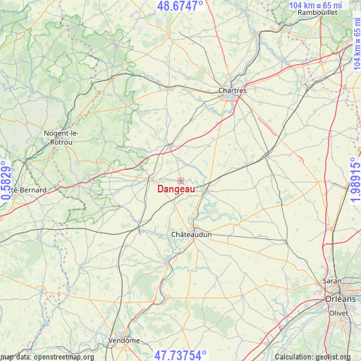
Dangeau GPS coordinates[2]
48° 12' 29.736" North, 1° 17' 9.708" East
| Map corner | latitude | longitude |
|---|---|---|
| Upper-left | 48.6747°, | 0.5829° |
| Center: | 48.20826°, | 1.28603° |
| Lower-right: | 47.73754°, | 1.98915° |
| Map W x H: | 104.2×104.2 km | = 64.7×64.7mi |
| max Lat: | 51.07786° ⇑37% North |
| Dangeau: | 48.20826° |
| min Lat: | ⇓63% South 41.3874° |
| min Long | Dangeau | max Long |
| -5.08615° | 1.28603° | 9.52242° |
| W 34.2%⇐ | ⇒65.8% E |
Elevation
Elevation of Dangeau is 141 m = 463 ft, and this is 52.7 m = 173 ft below average elevation for this country.
| Max E: |
2333 m = 7654 ft | 47.5% |
| Avg. | 193.7 m = 635 ft | |
| Dangeau | 141 m = 463 ft | |
Min E: |
-1 m = -3 ft | 52.5% |
See also: France elevation on elevation.city.
Geographical zone
Dangeau is located in North temperate zone (between Tropic of Cancer and the Arctic Circle). Distance of this North polar circle is 2040.9 km =1268.2 mi to North.| Distance of | km | miles | from Dangeau |
|---|---|---|---|
| North Pole | 4646.8 | 2887.4 | to North |
| Arctic Circle | 2040.9 | 1268.2 | to North |
| Tropic Cancer | 2754.3 | 1711.4 | to South |
| Equator | 5360.3 | 3330.7 | to South |


Nearby cities:
15 places around Dangeau: (largest is in red/bold)
• Alluyes
6.1 km =3.8 mi,  67°
67°
• Bonneval
7.9 km =4.9 mi,  110°
110°
• Brou
9 km =5.6 mi,  276°
276°
• Châteaudun
15.8 km =9.8 mi,  165°
165°
• Châtillon-en-Dunois
12.6 km =7.8 mi,  216°
216°
• Donnemain-Saint-Mamès
12.9 km =8 mi,  151°
151°
• Frazé
15 km =9.3 mi,  293°
293°
• Lanneray
13.9 km =8.6 mi,  193°
193°
• Le Gault-Saint-Denis
14.9 km =9.3 mi,  79°
79°
• Logron
7 km =4.3 mi, 192°
• Marboué
11 km =6.8 mi,  161°
161°
• Moléans
12.6 km =7.8 mi,  142°
142°
• Saint-Denis-les-Ponts
15.7 km =9.8 mi,  176°
176°
• Unverre
14.4 km =8.9 mi,  265°
265°
• Yèvres
7.3 km =4.5 mi, 272°
Sources, notices
• [Note1] Compared only with cities in France existing in our database
• [Src1] Map data: © OpenStreetMap contributors (CC-BY-SA)
• [Src2] Other city data from geonames.org with taken over terms of usage.
• [Src3] Geographical zone / Annual Mean Temperature by Robert A. Rohde @ Wikipedia
