Le Gault-Saint-Denis geodata
Le Gault-Saint-Denis (Centre) is a populated place; located in France in Europe/Paris (GMT+2) time zone. With population of 564 people, there are 13934 cities with bigger population in this country. Compared to other cities in France, 63.3% of cities are located further ↓South; 63.2% of cities are located further →East and 52.2% of cities have lower elevation than Le Gault-Saint-Denis. Note1
Administrative division(s):
- Level 1: Centre
- Level 2: Département d'Eure-et-Loir
- Level 3: Arrondissement de Châteaudun
- Level 4: Le Gault-Saint-Denis


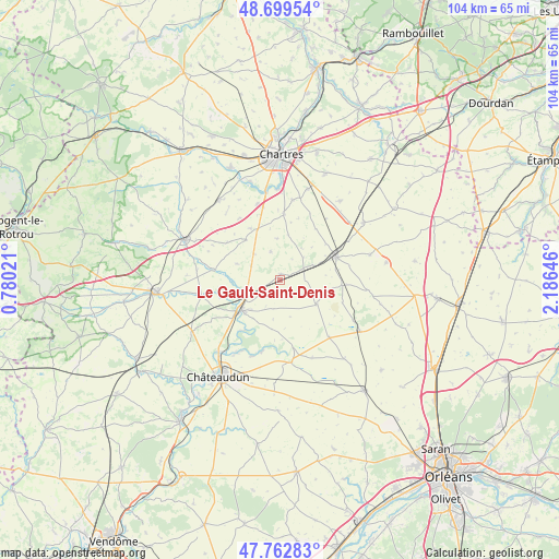
Le Gault-Saint-Denis GPS coordinates[2]
48° 13' 59.988" North, 1° 28' 59.988" East
| Map corner | latitude | longitude |
|---|---|---|
| Upper-left | 48.69954°, | 0.78021° |
| Center: | 48.23333°, | 1.48333° |
| Lower-right: | 47.76283°, | 2.18646° |
| Map W x H: | 104.2×104.1 km | = 64.7×64.7mi |
| max Lat: | 51.07786° ⇑36.7% North |
| Le Gault-Saint-Denis: | 48.23333° |
| min Lat: | ⇓63.3% South 41.3874° |
| min Long | Le Gault-Saint- | max Long |
| -5.08615° | 1.48333° | 9.52242° |
| W 36.8%⇐ | ⇒63.2% E |
Elevation
Elevation of Le Gault-Saint-Denis is 140 m = 459 ft, and this is 53.7 m = 176 ft below average elevation for this country.
| Max E: |
2333 m = 7654 ft | 47.8% |
| Avg. | 193.7 m = 635 ft | |
| Le Gault-Saint-Denis | 140 m = 459 ft | |
Min E: |
-1 m = -3 ft | 52.2% |
See also: France elevation on elevation.city.
Geographical zone
Le Gault-Saint-Denis is located in North temperate zone (between Tropic of Cancer and the Arctic Circle). Distance of this North polar circle is 2038.1 km =1266.4 mi to North.| Distance of | km | miles | from Le Gault-Saint-Denis |
|---|---|---|---|
| North Pole | 4644 | 2885.6 | to North |
| Arctic Circle | 2038.1 | 1266.4 | to North |
| Tropic Cancer | 2757.1 | 1713.2 | to South |
| Equator | 5363 | 3332.4 | to South |


Nearby cities:
15 places around Le Gault-Saint-Denis: (largest is in red/bold)
• Alluyes
9 km =5.6 mi,  267°
267°
• Berchères-les-Pierres
17.7 km =11 mi,  17°
17°
• Bonneval
9.2 km =5.7 mi,  232°
232°
• Dammarie
12.2 km =7.6 mi,  3°
3°
• Dangeau
14.9 km =9.3 mi,  259°
259°
• Donnemain-Saint-Mamès
16.5 km =10.3 mi,  210°
210°
• Marboué
17.4 km =10.8 mi,  220°
220°
• Mignières
14.7 km =9.1 mi,  342°
342°
• Moléans
14.6 km =9.1 mi, 208°
• Morancez
18.6 km =11.6 mi, 2°
• Orgères-en-Beauce
17.7 km =11 mi,  123°
123°
• Prunay-le-Gillon
18.4 km =11.4 mi,  37°
37°
• Sancheville
8.3 km =5.2 mi, 122°
• Thivars
16.3 km =10.1 mi,  351°
351°
• Voves
11.4 km =7.1 mi,  68°
68°
Sources, notices
• [Note1] Compared only with cities in France existing in our database
• [Src1] Map data: © OpenStreetMap contributors (CC-BY-SA)
• [Src2] Other city data from geonames.org with taken over terms of usage.
• [Src3] Geographical zone / Annual Mean Temperature by Robert A. Rohde @ Wikipedia
