Lanneray geodata
Lanneray (Centre) is a populated place; located in France in Europe/Paris (GMT+2) time zone. With population of 523 people, there are 14759 cities with bigger population in this country. Compared to other cities in France, 60.9% of cities are located further ↓South; 66.2% of cities are located further →East and 53.9% of cities have lower elevation than Lanneray. Note1
Administrative division(s):
- Level 1: Centre
- Level 2: Département d'Eure-et-Loir
- Level 3: Arrondissement de Châteaudun
- Level 4: Saint-Denis-Lanneray


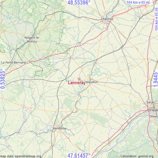
Lanneray GPS coordinates[2]
48° 5' 11.076" North, 1° 14' 28.968" East
| Map corner | latitude | longitude |
|---|---|---|
| Upper-left | 48.55396°, | 0.53825° |
| Center: | 48.08641°, | 1.24138° |
| Lower-right: | 47.61457°, | 1.9445° |
| Map W x H: | 104.5×104.4 km | = 64.9×64.9mi |
| max Lat: | 51.07786° ⇑39.1% North |
| Lanneray: | 48.08641° |
| min Lat: | ⇓60.9% South 41.3874° |
| min Long | Lanneray | max Long |
| -5.08615° | 1.24138° | 9.52242° |
| W 33.8%⇐ | ⇒66.2% E |
Elevation
Elevation of Lanneray is 146 m = 479 ft, and this is 47.7 m = 156 ft below average elevation for this country.
| Max E: |
2333 m = 7654 ft | 46.1% |
| Avg. | 193.7 m = 635 ft | |
| Lanneray | 146 m = 479 ft | |
Min E: |
-1 m = -3 ft | 53.9% |
See also: France elevation on elevation.city.
Geographical zone
Lanneray is located in North temperate zone (between Tropic of Cancer and the Arctic Circle). Distance of this North polar circle is 2054.5 km =1276.6 mi to North.| Distance of | km | miles | from Lanneray |
|---|---|---|---|
| North Pole | 4660.4 | 2895.8 | to North |
| Arctic Circle | 2054.5 | 1276.6 | to North |
| Tropic Cancer | 2740.8 | 1703.1 | to South |
| Equator | 5346.7 | 3322.3 | to South |


Nearby cities:
15 places around Lanneray: (largest is in red/bold)
• Arrou
8.5 km =5.3 mi,  278°
278°
• Châteaudun
7.4 km =4.6 mi,  103°
103°
• Châtillon-en-Dunois
5.3 km =3.3 mi,  308°
308°
• Cloyes-sur-le-Loir
9.9 km =6.2 mi,  181°
181°
• Courtalain
7.5 km =4.7 mi,  265°
265°
• Dangeau
13.9 km =8.6 mi,  13°
13°
• Donnemain-Saint-Mamès
9.7 km =6 mi,  76°
76°
• Droué
13.4 km =8.3 mi,  247°
247°
• Jallans
9.5 km =5.9 mi, 98°
• La Chapelle-du-Noyer
7.9 km =4.9 mi,  140°
140°
• Logron
6.9 km =4.3 mi, 14°
• Marboué
7.4 km =4.6 mi,  65°
65°
• Moléans
11.5 km =7.1 mi, 72°
• Saint-Denis-les-Ponts
4.7 km =2.9 mi,  117°
117°
• Saint-Hilaire-sur-Yerre
6.7 km =4.2 mi,  169°
169°
Sources, notices
• [Note1] Compared only with cities in France existing in our database
• [Src1] Map data: © OpenStreetMap contributors (CC-BY-SA)
• [Src2] Other city data from geonames.org with taken over terms of usage.
• [Src3] Geographical zone / Annual Mean Temperature by Robert A. Rohde @ Wikipedia
