Cuq-Toulza geodata
Cuq-Toulza (Occitanie) is a populated place; located in France in Europe/Paris (GMT+2) time zone. With population of 553 people, there are 14157 cities with bigger population in this country. Compared to other cities in France, 92.5% of cities are located further ↑North; 58.4% of cities are located further →East and 77.3% of cities have lower elevation than Cuq-Toulza. Note1
Administrative division(s):
- Level 1: Occitanie
- Level 2: Tarn
- Level 3: Arrondissement de Castres
- Level 4: Cuq-Toulza


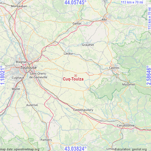
Cuq-Toulza GPS coordinates[2]
43° 33' 0" North, 1° 52' 59.988" East
| Map corner | latitude | longitude |
|---|---|---|
| Upper-left | 44.05745°, | 1.18021° |
| Center: | 43.55°, | 1.88333° |
| Lower-right: | 43.03824°, | 2.58646° |
| Map W x H: | 113.3×113.3 km | = 70.4×70.4mi |
| max Lat: | 51.07786° ⇑92.5% North |
| Cuq-Toulza: | 43.55° |
| min Lat: | ⇓7.5% South 41.3874° |
| min Long | Cuq-Toulza | max Long |
| -5.08615° | 1.88333° | 9.52242° |
| W 41.6%⇐ | ⇒58.4% E |
Elevation
Elevation of Cuq-Toulza is 266 m = 873 ft, and this is 72.3 m = 237 ft above average elevation for this country.
| Max E: |
2333 m = 7654 ft | 22.7% |
| Cuq-Toulza | 266 m 873 ft | |
| Avg. | 193.7 m = 635 ft | |
Min E: |
-1 m = -3 ft | 77.3% |
See also: France elevation on elevation.city.
Geographical zone
Cuq-Toulza is located in North temperate zone (between Tropic of Cancer and the Arctic Circle). Distance of this Northern Tropic circle is 2236.4 km =1389.6 mi to South.| Distance of | km | miles | from Cuq-Toulza |
|---|---|---|---|
| North Pole | 5164.8 | 3209.3 | to North |
| Arctic Circle | 2558.9 | 1590 | to North |
| Tropic Cancer | 2236.4 | 1389.6 | to South |
| Equator | 4842.3 | 3008.9 | to South |


Nearby cities:
15 places around Cuq-Toulza: (largest is in red/bold)
• Auriac-sur-Vendinelle
5.4 km =3.4 mi,  237°
237°
• Blan
10.5 km =6.5 mi,  104°
104°
• Bourg-Saint-Bernard
14.9 km =9.3 mi,  291°
291°
• Caraman
10.1 km =6.3 mi,  259°
259°
• Damiatte
13.6 km =8.5 mi,  33°
33°
• Fiac
17 km =10.6 mi,  6°
6°
• Labastide-Saint-Georges
16.9 km =10.5 mi,  349°
349°
• Lavaur
17.3 km =10.7 mi,  342°
342°
• Lempaut
14.9 km =9.3 mi, 99°
• Puylaurens
10.7 km =6.6 mi,  76°
76°
• Revel
14.1 km =8.8 mi,  136°
136°
• Saint-Félix-Lauragais
11.3 km =7 mi,  178°
178°
• Saint-Germain-des-Prés
14.8 km =9.2 mi, 84°
• Saint-Paul-Cap-de-Joux
13.2 km =8.2 mi, 34°
• Serviès
17 km =10.6 mi,  43°
43°
Sources, notices
• [Note1] Compared only with cities in France existing in our database
• [Src1] Map data: © OpenStreetMap contributors (CC-BY-SA)
• [Src2] Other city data from geonames.org with taken over terms of usage.
• [Src3] Geographical zone / Annual Mean Temperature by Robert A. Rohde @ Wikipedia
